7 cities

Location of SerbiaItalyVaticanNorth MacedoniaGreeceGermanyBosnia and HerzegovinaKosovoMoldovaSan MarinoTürkiyeMontenegroAustriaSwitzerlandBulgariaAlbaniaSlovakiaCroatiaSloveniaUkrainePolandLiechtensteinRomaniaCzechiaHungarySerbiaNisZrenjaninKragujevacNovi SadCacakSuboticaBelgrade
Country

Serbia

44.19° N, 20.79° E

No coast at all — every one of its 2,322 km of border is shared with another country.

coastline 0 km · 185th/229 · land borders 2,322 km · 82nd/230
CIA World Factbook · 2026-02-01 · ranks computed across the countries in this atlas that carry the value

Population
6,944,975
Area
77,474 km²
Population density
≈ 89 / km²
Capital
Belgrade
Natural Earth
ISO codes
RS · SRB
GDP (nominal)
$89.08 billion
GDP per capita (PPP)
$26,900
How big, reallyDrawn at the same scale as Lithuania. Equal-area projection, not the map you are used to.
Serbia 77,474 km²Lithuania 65,300 km²

geometry: Natural Earth 1:50m · EPSG:6933 equal-area

Where Serbia sits in the world

Each line is every country in this atlas that carries the value, ordered smallest to largest. The line down the middle is the world median; the mark on each line is this country.

  1. Median age44.1 years31st of 224 · median 32.6 years
  2. Life expectancy75.3 years125th of 224 · median 76.2 years
  3. Fertility rate1.47 children per woman186th of 225 · median 1.92 children per woman
  4. Population6,944,975107th of 235 · median 5,454,073
  5. Total area77,474 km²117th of 228 · median 83,736 km²
  6. Coastline0 km185th of 229 · median 402 km

Overview

Name

Serbia takes its name from the Serb people, but the origin of their name is unclear. It may derive from the Caucasian root word "ser", meaning "man".

Source: CIA World Factbook · 2026-02-01 · text generated from this source, approved by a person

Climate

In the north, a continental climate brings cold winters and hot, humid summers with well-distributed rainfall. Other parts have a continental and Mediterranean climate: relatively cold winters with heavy snowfall, and hot, dry summers and autumns.

Source: CIA World Factbook · 2026-02-01 · text generated from this source, approved by a person

People and society

The population includes Serb, Hungarian, Romani, and Bosniak groups, as well as others and people whose ethnicity is undeclared or unknown. Serbian is the official language, alongside Hungarian, Bosnian, Romani, other languages, and languages that are undeclared or unknown.

Religious identification includes Serbian Orthodox, Islam, Catholic, atheist, other Christians, Protestant, agnostic, unknown, and no response. Population is distributed fairly evenly through most of the country, while urban areas attract larger and denser populations.

Source: CIA World Factbook · 2026-02-01 · text generated from this source, approved by a person

Flag and symbols

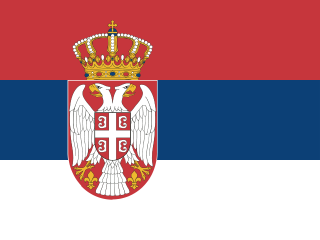
Red, blue, and white horizontal stripes form the flag; its coat of arms is shifted left. The arms show a white double-headed eagle on a red shield, a smaller red shield quartered by a white cross, and a royal crown. Colors represent freedom and revolutionary ideals; the eagle on a red shield represents the government, and the smaller shield represents the country. The white double-headed eagle is the national symbol.

Source: CIA World Factbook · 2026-02-01 · text generated from this source, approved by a person
Key figures

CIA World Factbook

Economy

GDP (nominal)
$89.08 billion
GDP (PPP)
$177.09 billion
GDP per capita (PPP)
$26,900
GDP growth
+3.9%
Inflation (consumer prices)
4.7%
Unemployment
7.4%
Exports
$44.35 billion
Imports
$48.16 billion

People

Life expectancy
75.3 years
Median age
44.1 years
Birth rate
8.72 per 1,000
Death rate
14.66 per 1,000
Fertility rate
1.47 children per woman
Population growth
-0.6% a year
Urban population
57.1%
Literacy
99.3%
Languages
  • Serbianofficial88.1%
  • Hungarian3.4%
  • Bosnian1.9%
  • Romani1.4%
  • undeclared or unknown1.8%
  • others3.4%

Land

Total area
77,474 km²Land 77,474 km² · Water 0 km²
Coastline
0 km
Land borders
2,322 km
Mean elevation
442 m
Highest point
2,169 m Midzor

Values from the CIA World Factbook archive. Each carries the year it describes; open a year for the exact source field.

Connections

Natural geography 3

Natural Earth outlines · features with a Wikidata ID

Peninsulas 1

Largest cities 7

Population · Natural Earth

  1. Belgradecapital1.1M
  2. Nis250K
  3. Novi Sad225.5K
  4. Kragujevac171.2K
  5. Cacak170K
  6. Subotica100K
  7. Zrenjanin64.1K

Sources