Name
The name derives from the brazil tree, which used to grow plentifully along Brazil's coast and supplied a deep red dye.
Source: CIA World Factbook · 2026-02-01 · text generated from this source, approved by a person
 Brazil
12.10° S, 49.56° W
Land borders of 16,145 km — the 3rd highest of 230 countries.
land borders 16,145 km · 3rd/230
CIA World Factbook · 2026-02-01 · ranks computed across the countries in this atlas that carry the value
geometry: Natural Earth 1:50m · EPSG:6933 equal-area
Each line is every country in this atlas that carries the value, ordered smallest to largest. The line down the middle is the world median; the mark on each line is this country.
The name derives from the brazil tree, which used to grow plentifully along Brazil's coast and supplied a deep red dye.
Source: CIA World Factbook · 2026-02-01 · text generated from this source, approved by a person
A mostly tropical climate becomes temperate in the south. The northeast has recurring droughts, while the south experiences floods and occasional frost.
Source: CIA World Factbook · 2026-02-01 · text generated from this source, approved by a person
Mixed, White, Black, Indigenous, and Asian groups are among Brazil's people. Portuguese is the official and most widely spoken language. Less common languages include Spanish in border areas and schools, German, Italian, Japanese, English, and many minor Amerindian languages.
People report Roman Catholic, Evangelical, or none, as well as Spirtism (Espírita), Umbanda and Candomblé, and Indigenous religions. The vast majority of people live along or near the Atlantic coast in the east. In the southeast, the population core is anchored by the cities of São Paolo, Brasília, and Rio de Janeiro.
Source: CIA World Factbook · 2026-02-01 · text generated from this source, approved by a person
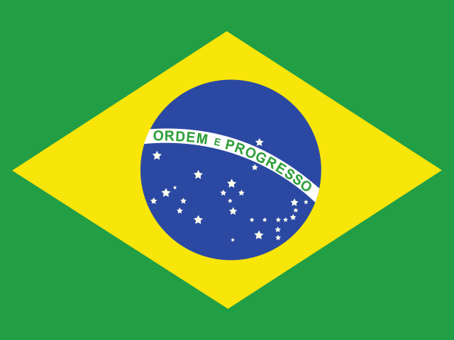
Green surrounds a yellow diamond at Brazil’s flag center, showing a blue celestial globe with five-pointed white stars. The white equatorial band carries “ORDEM E PROGRESSO” (“Order and Progress”); green stands for forests, yellow for mineral wealth, and the diamond represents the country’s shape. The globe and stars depict Rio de Janeiro’s sky on 15 November 1889, when the Republic of Brazil was declared. The Southern Cross constellation is a national symbol.
Source: CIA World Factbook · 2026-02-01 · text generated from this source, approved by a person
CIA World Factbook
Values from the CIA World Factbook archive. Each carries the year it describes; open a year for the exact source field.
Natural Earth outlines · features with a Wikidata ID
Population · Natural Earth