Name
A local people gave Rwanda its name, but the meaning of their own name is obscure.
Source: CIA World Factbook · 2026-02-01 · text generated from this source, approved by a person
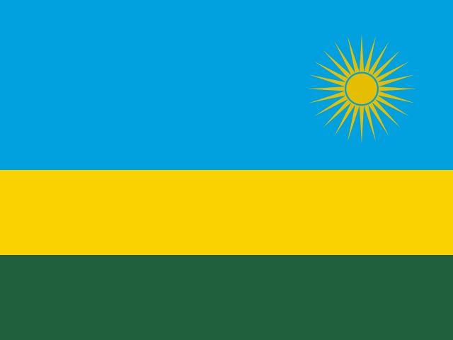 Rwanda
1.90° S, 30.10° E
No coast at all — every one of its 930 km of border is shared with another country.
coastline 0 km · 185th/229 · land borders 930 km · 125th/230
CIA World Factbook · 2026-02-01 · ranks computed across the countries in this atlas that carry the value
geometry: Natural Earth 1:50m · EPSG:6933 equal-area
Each line is every country in this atlas that carries the value, ordered smallest to largest. The line down the middle is the world median; the mark on each line is this country.
A local people gave Rwanda its name, but the meaning of their own name is obscure.
Source: CIA World Factbook · 2026-02-01 · text generated from this source, approved by a person
Rugged hills and fertile volcanic soil mark a small, centralized country influential across the African Great Lakes region for centuries. From the mid-18th century onward, a Rwandan kingdom expanded through military conquest as Tutsi monarchs extended royal authority into peripheral areas; social categories hardened during Rwabugiri’s reign (1860-1895). Hutu and Tutsi labels predated colonial rule but often reflected hierarchical class distinctions; the groups shared a language and culture, and intermarriage was frequent.
German colonial conquest began in the late 1890s, but the territory was ceded to Belgian forces in 1916; colonial rule eliminated traditional Hutu authority and imposed communal labor requirements and harsh taxes. In 1959, Hutus overthrew the Tutsi king. Habyarimana seized power in a coup in 1973, established single-party rule, and discriminated against Tutsis as extremist Hutu factions gained prominence in the early 1990s. Tutsi exiles’ children formed the RPF and began civil war in 1990, which culminated in Habyarimana’s private jet being shot down in 1994. The shooting sparked a state-orchestrated genocide; later in 1994, the RPF defeated the national army and Hutu militias and established an RPF-led government of national unity. Rwanda held its first local elections in 1999 and its first post-genocide presidential and legislative elections in 2003, formalizing Kagame’s de facto role as head of government. Kagame was formally elected in 2010 and again in 2017 after changing the constitution to allow a third term.
Source: CIA World Factbook · 2026-02-01 · text generated from this source, approved by a person
Landlocked in Central Africa, Rwanda lies east of the Democratic Republic of the Congo and north of Burundi. Its terrain consists mostly of grassy uplands and hills, with mountainous relief declining in altitude from west to east. Most of the country is intensively cultivated and rugged, and its population is predominantly rural.
Rwanda’s natural resources include gold, cassiterite (tin ore), wolframite (tungsten ore), methane, hydropower, and arable land. Volcan Karisimbi is the highest point. The Rusizi River is the lowest point.
Source: CIA World Factbook · 2026-02-01 · text generated from this source, approved by a person
Hutu, Tutsi, and Twa are its ethnic groups. Kinyarwanda, a universal Bantu vernacular, is official, while French, English, and Swahili/Kiswahili are also official languages. Swahili/Kiswahili is used in commercial centers.
Religious affiliations include Catholic, Pentecostal, Protestant, Adventist, and other Christians. Muslim, other religions, and no religion are also represented. Among Africa's most densely populated countries, Rwanda has large concentrations in the central regions and along the shore of Lake Kivu in the west.
Source: CIA World Factbook · 2026-02-01 · text generated from this source, approved by a person
A presidential republic governs the country. Its legal system is a mixed system of civil law, based on German and Belgian models, and customary law; the Supreme Court reviews legislative acts. The latest constitution was adopted by referendum 26 May 2003 and took effect 4 June 2003. Independence came on 1 July 1962 from Belgium-administered UN trusteeship. The national holiday is Independence Day, 1 July (1962).
Source: CIA World Factbook · 2026-02-01 · text generated from this source, approved by a person
CIA World Factbook
Values from the CIA World Factbook archive. Each carries the year it describes; open a year for the exact source field.
Natural Earth outlines · features with a Wikidata ID
Population · Natural Earth