Name
The name Peru may derive from the Guarani word "biru," meaning "river".
Source: CIA World Factbook · 2026-02-01 · text generated from this source, approved by a person
 Peru
Peru12.98° S, 72.90° W
Mean elevation of 1,555 m — the 14th highest of 168 countries.
mean elevation 1,555 m · 14th/168
CIA World Factbook · 2026-02-01 · ranks computed across the countries in this atlas that carry the value
geometry: Natural Earth 1:50m · EPSG:6933 equal-area
Each line is every country in this atlas that carries the value, ordered smallest to largest. The line down the middle is the world median; the mark on each line is this country.
The name Peru may derive from the Guarani word "biru," meaning "river".
Source: CIA World Factbook · 2026-02-01 · text generated from this source, approved by a person
Ancient Peru was the seat of prominent Andean civilizations, including the Incas, whose empire Spanish conquistadors captured in 1533. Peru declared its independence in 1821, and remaining Spanish forces were defeated in 1824. After a dozen years of military rule, Peru returned to democratic leadership in 1980, but economic problems and the growth of a violent insurgency followed. Alberto Fujimori's election in 1990 brought economic turnaround and progress curtailing guerrilla activity, but dissatisfaction over later economic and authoritarian problems led to his resignation in 2000.
The 2001 election installed Alejandro Toledo Manrique as Peru's first democratically elected president of indigenous ethnicity. Alan Garcia Perez returned in 2006, followed by Ollanta Humala Tasso in 2011. Pedro Pablo Kuczynski Godard won a narrow runoff in 2016 but offered his resignation in 2018 after a vote-buying scandal. Martin Alberto Vizcarra Cornejo became president, dissolved Congress in 2019 over anticorruption reforms, and was impeached and removed after 2020 elections. Manuel Merino became president after Vizcarra's removal, but protests forced his resignation later in 2020; Francisco Sagasti then assumed the presidency. Jose Pedro Castillo Terrones won in 2021 but was impeached and ousted the following year, when Dina Boluarte assumed the presidency by constitutional succession.
Source: CIA World Factbook · 2026-02-01 · text generated from this source, approved by a person
Between Chile and Ecuador, Peru borders the South Pacific Ocean in western South America. From the coast inland, the western coastal plain, or costa, gives way to the high and rugged Andes, or sierra. Eastward, the land descends to the lowland jungle of the Amazon Basin, or selva.
Peru shares control of Lago Titicaca with Bolivia; it is the world's highest navigable lake. A remote slope of Nevado Mismi is the ultimate source of the Amazon River. Peru lies along the Ring of Fire, a belt bordering the Pacific Ocean that contains volcanoes and earthquakes. Its natural resources include copper, silver, gold, petroleum, timber, fish, iron ore, coal, phosphate, potash, hydropower, and natural gas.
Source: CIA World Factbook · 2026-02-01 · text generated from this source, approved by a person
From tropical conditions in the east to dry desert in the west, Peru's climate varies from temperate to frigid in the Andes.
Source: CIA World Factbook · 2026-02-01 · text generated from this source, approved by a person
Peru's people include Mestizo, meaning people of mixed Indigenous and White descent, Indigenous, White, African descent, and people of other backgrounds, including Chinese and Japanese descent. Spanish, Quechua, and Aymara are official languages; Ashaninka and other native languages, including many minor Amazonian languages, are also spoken. Religious affiliations include Catholic, Evangelical Christian, no religion, and other religions.
People live along the desert coastal belt in the west, with a strong focus on the capital city of Lima. The Andean highlands, or sierra, contain residents, while the eastern slopes of the Andes and adjoining rainforest are sparsely populated.
Source: CIA World Factbook · 2026-02-01 · text generated from this source, approved by a person
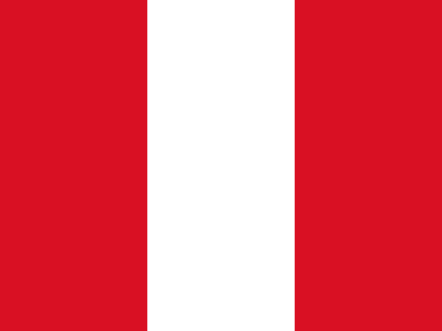
Three equal vertical bands—red at the left, white in the center, and red at the right—form the flag. The coat of arms is centered on the white band and has a shield with a vicuna, a cinchona tree, and a yellow cornucopia spilling out coins. The vicuna represents fauna, the cinchona tree is the source of quinine, and the cornucopia symbolizes mineral wealth. Red stands for blood shed for independence, and white for peace. The vicuna, a camelid related to the llama, is a national symbol.
Source: CIA World Factbook · 2026-02-01 · text generated from this source, approved by a person
CIA World Factbook
Values from the CIA World Factbook archive. Each carries the year it describes; open a year for the exact source field.
Natural Earth outlines · features with a Wikidata ID
Population · Natural Earth