Overview
Background
The name Montenegro, or Black Mountain, began in the 13th century as a reference to a highland region in the Serbian province of Zeta. Under Ottoman control beginning in 1496, Montenegro was a semi-autonomous theocracy ruled by a series of bishop princes until 1852, when it became a secular principality. It fought a series of wars with the Ottomans and eventually won recognition as an independent sovereign principality at the Congress of Berlin in 1878.
In 1918, the country was absorbed by the Kingdom of Serbs, Croats, and Slovenes, which became the Kingdom of Yugoslavia in 1929. At the end of World War II, Montenegro joined the Socialist Federal Republic of Yugoslavia (SFRY). When the SFRY dissolved in 1992, Montenegro and Serbia created the Federal Republic of Yugoslavia (FRY), which shifted in 2003 to a looser State Union of Serbia and Montenegro. Montenegro voted to restore its independence on 3 June 2006, became an official EU candidate in 2010, and joined NATO in 2017.
Source: CIA World Factbook · 2026-02-01 · text generated from this source, approved by a person
Climate
A Mediterranean climate brings hot, dry summers and autumns, while winters are relatively cold, with heavy snowfalls inland.
Source: CIA World Factbook · 2026-02-01 · text generated from this source, approved by a person
People and society
Montenegrin, Serbian, Bosniak, Albanian, Muslim, Romani, and Croat communities live alongside others.
Serbian, Montenegrin, Bosnian, Albanian, Serbo-Croat, and other languages are spoken; Montenegrin is official. People identify as Orthodox, Muslim, Catholic, atheist, or other, while some affiliations are unspecified. The highest population density is concentrated in the south and southwest, while the extreme eastern border is the least populated area.
Source: CIA World Factbook · 2026-02-01 · text generated from this source, approved by a person
Government
A parliamentary republic is the form of government. Its legal system is civil law. The latest constitution was adopted 22 October 2007. Independence came 3 June 2006 from the State Union of Serbia and Montenegro. The national holiday is Statehood Day, 13 July (1878, 1941).
Source: CIA World Factbook · 2026-02-01 · text generated from this source, approved by a person
Flag and symbols
A red field bears a narrow golden-yellow stripe and centered coat of arms: a double-headed golden eagle with crown above. Its right claw holds a golden scepter, its left a blue orb. The breast shield shows a golden lion on a green field before a blue sky. The double-headed eagle is the national symbol and symbolizes the unity of church and state. The lion is a symbol of episcopal authority.
Source: CIA World Factbook · 2026-02-01 · text generated from this source, approved by a person
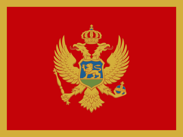 Montenegro