Name
The name means "depths" in Spanish and refers to the deep anchorage in the northern Bay of Trujillo.
Source: CIA World Factbook · 2026-02-01 · text generated from this source, approved by a person
 Honduras
14.79° N, 86.89° W
geometry: Natural Earth 1:50m · EPSG:6933 equal-area
Each line is every country in this atlas that carries the value, ordered smallest to largest. The line down the middle is the world median; the mark on each line is this country.
The name means "depths" in Spanish and refers to the deep anchorage in the northern Bay of Trujillo.
Source: CIA World Factbook · 2026-02-01 · text generated from this source, approved by a person
Honduras has only a short Pacific coast but a long Caribbean shoreline, including the virtually uninhabited eastern Mosquito Coast. Between Guatemala and Nicaragua, Honduras borders the Caribbean Sea; between El Salvador and Nicaragua, it borders the Gulf of Fonseca in the North Pacific Ocean.
Its interior is mostly mountains, with narrow coastal plains. Natural resources include timber, gold, silver, copper, lead, zinc, iron ore, antimony, coal, fish, and hydropower. Cerro Las Minas is Honduras's highest point. The Caribbean Sea is Honduras's lowest point.
Source: CIA World Factbook · 2026-02-01 · text generated from this source, approved by a person
Lowlands have a subtropical climate, while mountains have a temperate one. The Caribbean coast is extremely susceptible to damaging hurricanes and floods.
Source: CIA World Factbook · 2026-02-01 · text generated from this source, approved by a person
The mountainous western half holds most residents, while urban population is distributed between Tegucigalpa and San Pedro Sula. In the north, the Rio Ulua valley is the only densely populated lowland area.
Mestizo, meaning mixed Indigenous and European, Indigenous, African descent, and White people make up the country's ethnic groups. Spanish is the official language, alongside Amerindian dialects. Religious affiliations include Evangelical, Roman Catholic, none, and unspecified affiliations.
Source: CIA World Factbook · 2026-02-01 · text generated from this source, approved by a person
Government takes the form of a presidential republic. It has a civil law system. The latest constitution was approved 11 January 1982 and took effect 20 January 1982, following several previous constitutions. Independence from Spain came on 15 September 1821. The national holiday is Independence Day, 15 September (1821).
Source: CIA World Factbook · 2026-02-01 · text generated from this source, approved by a person
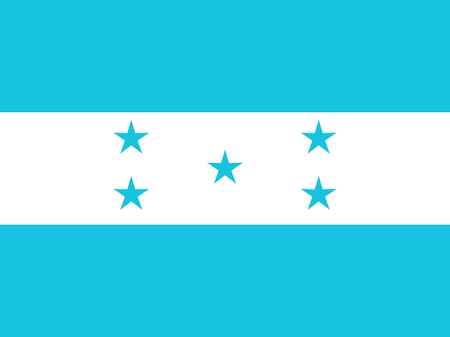
Three equal horizontal bands of cerulean blue, white, and cerulean blue carry five five-pointed cerulean stars in an X pattern centered in the white band. The stars represent members of the former Federal Republic of Central America: Costa Rica, El Salvador, Guatemala, Honduras, and Nicaragua. Blue stands for Pacific Ocean and Caribbean Sea; white stands for land and people's peace and prosperity. The scarlet macaw and white-tailed deer are national symbols.
Source: CIA World Factbook · 2026-02-01 · text generated from this source, approved by a person
CIA World Factbook
Values from the CIA World Factbook archive. Each carries the year it describes; open a year for the exact source field.
Natural Earth outlines · features with a Wikidata ID
Population · Natural Earth