Overview
Name
A 16th-century Spanish explorer, Gil Gonzalez Davila, is said to have combined the local chieftain Nicarao's name with the Spanish word "agua," referring to Lake Managua and Lake Nicaragua.
Source: CIA World Factbook · 2026-02-01 · text generated from this source, approved by a person
Background
The Pacific coast of Nicaragua was settled as a Spanish colony in the early 16th century, while Britain occupied the Caribbean Coast and ceded control in subsequent decades. Independence from Spain was declared in 1821, and Nicaragua became an independent republic in 1838. By 1978, violent opposition to governmental manipulation and corruption produced a short-lived civil war, bringing a civil-military coalition to power in 1979. Nicaraguan aid to leftist rebels in El Salvador prompted the US to sponsor anti-Sandinista Contra guerrillas through much of the 1980s.
After losing free and fair elections in 1990, 1996, and 2001, Ortega was elected president in 2006, 2011, 2016, and 2021. Elections since 2008 have been marred by widespread irregularities. Under the Ortega regime, democratic institutions lost independence as the president assumed control over government branches. The regime cracked down on a pro-democracy movement in 2018, shuttered civil society organizations between 2018 and 2024, and arrested opposition figures before the 2021 presidential election. Presidential candidates from mostly small parties allied to Ortega's Sandinistas were allowed to run against Ortega. He then awarded the Sandinistas control of Nicaragua's municipalities in the 2022 municipal elections, consolidating one-party rule.
Source: CIA World Factbook · 2026-02-01 · text generated from this source, approved by a person
Geography
Lago de Nicaragua, the largest freshwater body in Central America, lies within Nicaragua. In Central America, Nicaragua borders both the Caribbean Sea and the North Pacific Ocean, between Costa Rica and Honduras. Extensive Atlantic coastal plains rise toward central interior mountains, while a narrow Pacific coastal plain is interrupted by volcanoes.
Its natural resources include gold, silver, copper, tungsten, lead, zinc, timber, and fish. Mogoton is Nicaragua's highest point. The Pacific Ocean is Nicaragua's lowest point.
Source: CIA World Factbook · 2026-02-01 · text generated from this source, approved by a person
Climate
Lowlands have a tropical climate, while highlands are cooler.
Source: CIA World Factbook · 2026-02-01 · text generated from this source, approved by a person
Flag and symbols
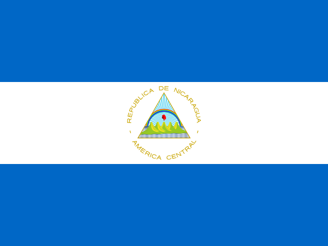
The flag has three equal horizontal bands of blue, white, and blue, with the national coat of arms centered in the white band. Its coat of arms has a triangle with REPUBLICA DE NICARAGUA in an arc over it and AMERICA CENTRAL in an arc underneath. Blue stands for the Pacific Ocean and the Caribbean Sea, and white for the land between the two bodies of water. The national symbol is the turquoise-browed motmot (bird).
Source: CIA World Factbook · 2026-02-01 · text generated from this source, approved by a person
 Nicaragua