Name
The country name derives from the capital city of Algiers.
Source: CIA World Factbook · 2026-02-01 · text generated from this source, approved by a person
 Algeria
27.40° N, 2.81° E
6,734 km of land border against just 998 km of coast — this country faces its neighbors far more than it faces the sea.
coastline 998 km · 84th/229 · land borders 6,734 km · 18th/230
CIA World Factbook · 2026-02-01 · ranks computed across the countries in this atlas that carry the value
geometry: Natural Earth 1:50m · EPSG:6933 equal-area
Each line is every country in this atlas that carries the value, ordered smallest to largest. The line down the middle is the world median; the mark on each line is this country.
The country name derives from the capital city of Algiers.
Source: CIA World Factbook · 2026-02-01 · text generated from this source, approved by a person
A dry climate ranges from arid to semiarid, with coastal winters mild and wet and summers hot and dry. The high plateau is drier, with cold winters and hot summers; the sirocco is a hot, dust- and sand-laden wind especially common in summer.
Source: CIA World Factbook · 2026-02-01 · text generated from this source, approved by a person
The country's ethnic groups are Arab-Amazigh and European. Arabic and Tamazight are official languages, while French is a lingua franca. Tamazight dialects include Kabyle (Taqbaylit), Shawiya (Tacawit), Mzab, and Tuareg (Tamahaq).
The official religion is Muslim, predominantly Sunni, with Christian, Jewish, Ahmadi Muslim, Shia Muslim, and Ibadi Muslim among other affiliations. The vast majority of the populace is found in the extreme northern part of the country along the Mediterranean Coast.
Source: CIA World Factbook · 2026-02-01 · text generated from this source, approved by a person
A presidential republic governs the country. Its legal system combines French civil law and Islamic law. An ad hoc Constitutional Council composed of various public officials, including several Supreme Court justices, provides judicial review of legislative acts. The latest constitution, following several previous constitutions, was approved by referendum 1 November 2020. Independence Day, 5 July (1962), marks independence from France, while Revolution Day falls on 1 November (1954).
Source: CIA World Factbook · 2026-02-01 · text generated from this source, approved by a person
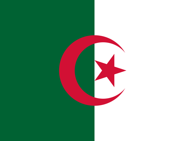
Two equal vertical bands, green on the left and white on the right, form the flag, with a red, five-pointed star inside a red crescent centered over their boundary. Green represents Islam, white purity and peace, and red liberty. The crescent and star are also Islamic symbols. National symbols include a five-pointed star between the extended horns of a crescent moon and the fennec fox.
Source: CIA World Factbook · 2026-02-01 · text generated from this source, approved by a person
CIA World Factbook
Values from the CIA World Factbook archive. Each carries the year it describes; open a year for the exact source field.
Natural Earth outlines · features with a Wikidata ID
Population · Natural Earth