Name
The country's name derives from Tunis, its capital city.
Source: CIA World Factbook · 2026-02-01 · text generated from this source, approved by a person
 Tunisia
33.69° N, 9.01° E
geometry: Natural Earth 1:50m · EPSG:6933 equal-area
Each line is every country in this atlas that carries the value, ordered smallest to largest. The line down the middle is the world median; the mark on each line is this country.
The country's name derives from Tunis, its capital city.
Source: CIA World Factbook · 2026-02-01 · text generated from this source, approved by a person
Mild, rainy winters and hot, dry summers mark the temperate climate in the north. In the south, the climate is desert.
Source: CIA World Factbook · 2026-02-01 · text generated from this source, approved by a person
A parliamentary republic is the form of government. The mixed legal system is based on the French civil code and Islamic (sharia) law; the Supreme Court reviews some legislative acts in joint session. The latest constitution was adopted 27 July 2022, after its draft was published by the president 30 June 2022 and approved by referendum 25 July 2022. Tunisia gained independence from France on 20 March 1956. The national holidays are Independence Day, 20 March (1956), and Revolution and Youth Day, 14 January (2011).
Source: CIA World Factbook · 2026-02-01 · text generated from this source, approved by a person
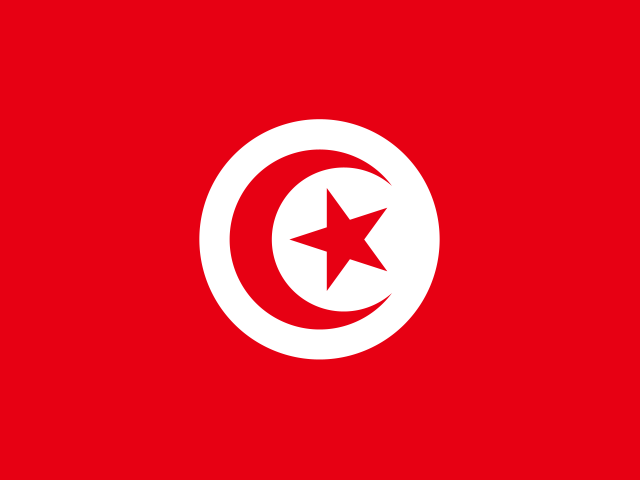
A red flag has a white disk at its center, with a red crescent around a five-pointed red star. Red stands for martyrs' blood shed in the fight against oppression, and white for peace. The crescent and star are traditional symbols of Islam; this design resembles the Ottoman flag, referencing Tunisia's history as part of the Ottoman Empire. The national symbols are a red crescent moon and five-pointed star in a white circle.
Source: CIA World Factbook · 2026-02-01 · text generated from this source, approved by a person
CIA World Factbook
Values from the CIA World Factbook archive. Each carries the year it describes; open a year for the exact source field.
Natural Earth outlines · features with a Wikidata ID
Population · Natural Earth