Background
The Danes secured control over the southern Virgin Islands of Saint Thomas, Saint John, and Saint Croix during the 17th and early 18th centuries. Sugarcane, produced by African slave labor, drove the islands' economy during the 18th and early 19th centuries. In 1917, the US purchased the Danish holdings, which had been in economic decline since the abolition of slavery in 1848.
In 2017, Hurricane Irma passed over the northern Virgin Islands of Saint Thomas and Saint John, inflicting severe damage to structures, roads, the airport on Saint Thomas, communications, and electricity. Less than two weeks later, Hurricane Maria passed over the island of Saint Croix in the southern Virgin Islands, inflicting considerable damage with heavy winds and flooding rains.
Source: CIA World Factbook · 2026-02-01 · text generated from this source, approved by a person
Climate
Easterly trade winds temper the subtropical climate, which has relatively low humidity and little seasonal temperature variation. A rainy season runs from September through November.
Source: CIA World Factbook · 2026-02-01 · text generated from this source, approved by a person
Government
As an unincorporated organized territory of the US, the United States Virgin Islands has local self-government. It has a republican form of territorial government with separate executive, legislative, and judicial branches. Its legal system is US common law. Since 22 July 1954, the Revised Organic Act of the Virgin Islands functions as a constitution for this US territory. The United States Virgin Islands has no independence; it is a territory of the US. Its national holiday is Transfer Day, marking the transfer from Denmark to the US on 31 March (1917).
Source: CIA World Factbook · 2026-02-01 · text generated from this source, approved by a person
Flag and symbols
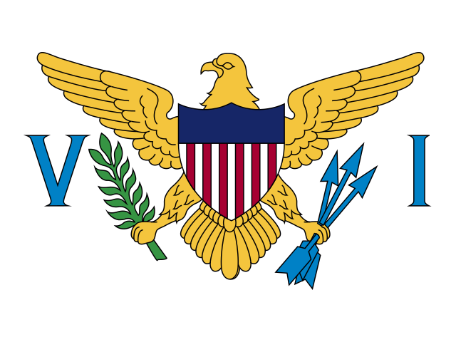
A white field carries a modified US coat of arms at its center, between the large blue initials V and I. The coat of arms shows a yellow eagle holding an olive branch in its right talon and three arrows in its left, above a shield of seven red and six white vertical stripes below a blue panel; white is a symbol of purity, and the letters stand for the Virgin Islands.
Source: CIA World Factbook · 2026-02-01 · text generated from this source, approved by a person
 United States Virgin Islands