10 cities

Location of PortugalSpainItalyMaltaGuernseyVaticanBosnia and HerzegovinaWestern SaharaGermanyMaliLibyaUnited KingdomSan MarinoMonacoJerseyAndorraFranceAustriaLuxembourgSwitzerlandNetherlandsSlovakiaCroatiaSloveniaBelgiumAlgeriaPolandMoroccoNigerTunisiaIrelandMauritaniaCzechiaHungaryMontenegroLiechtensteinPortugalLisbonPortimaoEvoraPonta DelgadaPortoBragaAveiroFunchalSetubalCoimbra
Country

Portugal

39.61° N, 8.27° W

For every 8.03 per 1,000 births there are 10.92 per 1,000 deaths — the population is falling 0.11% a year.

population growth -0.11% · 194th/230 · birth rate 8.03 per 1,000 · 202nd/226 · death rate 10.92 per 1,000 · 30th/226
CIA World Factbook · 2026-02-01 · ranks computed across the countries in this atlas that carry the value

Population
10,269,417
Area
92,090 km²
Population density
≈ 113 / km²
Capital
Lisbon
Natural Earth
ISO codes
PT · PRT
GDP (nominal)
$308.68 billion
GDP per capita (PPP)
$41,900
How big, reallyDrawn at the same scale as Sierra Leone. Equal-area projection, not the map you are used to.
Portugal 92,090 km²Sierra Leone 71,740 km²

geometry: Natural Earth 1:50m · EPSG:6933 equal-area

Where Portugal sits in the world

Each line is every country in this atlas that carries the value, ordered smallest to largest. The line down the middle is the world median; the mark on each line is this country.

  1. Median age46.8 years11th of 224 · median 32.6 years
  2. Life expectancy81.9 years37th of 224 · median 76.2 years
  3. Fertility rate1.46 children per woman188th of 225 · median 1.92 children per woman
  4. Population10,269,41788th of 235 · median 5,454,073
  5. Total area92,090 km²111th of 228 · median 83,736 km²
  6. Coastline1,793 km61st of 229 · median 402 km

Overview

Name

Portugal derives from the Roman designation "Portus Cale," meaning "Port of Cale." Cale was located in present-day northern Portugal, and its name is said to come from the Latin word "calere," meaning "to be warm," because the harbor never iced over.

Source: CIA World Factbook · 2026-02-01 · text generated from this source, approved by a person

Background

A global maritime power during the 15th and 16th centuries, Portugal lost much of its wealth and status with Lisbon's destruction in a 1755 earthquake, occupation during the Napoleonic Wars, and the independence of Brazil, its wealthiest colony, in 1822. A revolution deposed the monarchy in 1910, and repressive governments ran the country for much of the period that followed.

In 1974, a left-wing military coup ushered in broad democratic reforms, and the following year Portugal granted independence to all its African colonies. Portugal is a founding member of NATO and entered the EC, now the EU, in 1986.

Source: CIA World Factbook · 2026-02-01 · text generated from this source, approved by a person

Geography

In southwestern Europe, the country borders the North Atlantic Ocean and lies west of Spain. The west-flowing Tagus River divides the country, with mountainous terrain toward the interior in the north and rolling plains across the south. Ponta do Pico (Pico or Pico Alto) is the highest point, on Ilha do Pico in the Azores. The Atlantic Ocean is the lowest point.

Azores and Madeira Islands occupy strategic locations along western sea approaches to Strait of Gibraltar. Macaronesia also includes the Canary Islands (Spain) and Cabo Verde. Portugal's natural resources include fish, forests (cork), iron ore, copper, zinc, tin, tungsten, silver, gold, uranium, marble, clay, gypsum, salt, arable land, and hydropower.

Source: CIA World Factbook · 2026-02-01 · text generated from this source, approved by a person

Climate

A maritime temperate climate brings cool, rainy conditions in the north and warmer, drier conditions in the south.

Source: CIA World Factbook · 2026-02-01 · text generated from this source, approved by a person

Flag and symbols

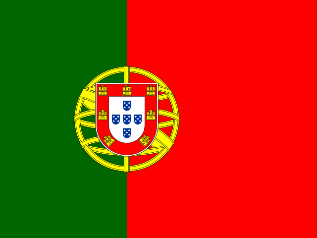
Green and red form vertical bands, with green on the left and red on the right. The coat of arms, with an armillary sphere and national shield, centers on the dividing line. The armillary sphere is a national symbol and a spherical astrolabe for modeling objects in the sky. Explanations for color meanings are ambiguous, but a popular interpretation says green symbolizes hope and red symbolizes the blood of those defending the nation.

Source: CIA World Factbook · 2026-02-01 · text generated from this source, approved by a person
Key figures

CIA World Factbook

Economy

GDP (nominal)
$308.68 billion
GDP (PPP)
$448.23 billion
GDP per capita (PPP)
$41,900
GDP growth
+1.9%
Inflation (consumer prices)
2.4%
Unemployment
6.4%
Exports
$144.24 billion
Imports
$136.98 billion

People

Life expectancy
81.9 years
Median age
46.8 years
Birth rate
8.03 per 1,000
Death rate
10.92 per 1,000
Fertility rate
1.46 children per woman
Population growth
-0.11% a year
Urban population
67.9%
Languages
  • Portugueseofficial
  • Mirandeseofficial

Land

Total area
92,090 km²Land 91,470 km² · Water 620 km²
Coastline
1,793 km
Land borders
1,224 km
Mean elevation
372 m
Highest point
2,351 m Ponta do Pico (Pico or Pico Alto) on Ilha do Pico in the Azores

Values from the CIA World Factbook archive. Each carries the year it describes; open a year for the exact source field.

Connections

Natural geography 9

Natural Earth outlines · features with a Wikidata ID

Island groups 1

Largest cities 10

Population · Natural Earth

  1. Lisboncapital2.8M
  2. Porto1.3M
  3. Braga826.8K
  4. Funchal204.8K
  5. Setubal118K
  6. Coimbra106.6K
  7. Ponta Delgada61.5K
  8. Portimao61.2K
  9. Evora55.6K
  10. Aveiro54.2K

Sources