Name
Its name comes from the ancient kingdom of Mauretania, whose name derives from the "Mauri" (Moors) of northwest Africa.
Source: CIA World Factbook · 2026-02-01 · text generated from this source, approved by a person
 Mauritania
19.59° N, 9.74° W
The population grows 2.88% a year, at 34.01 per 1,000 births per 1,000 people.
population growth +2.88% · 11th/230 · birth rate 34.01 per 1,000 · 15th/226
CIA World Factbook · 2026-02-01 · ranks computed across the countries in this atlas that carry the value
geometry: Natural Earth 1:50m · EPSG:6933 equal-area
Each line is every country in this atlas that carries the value, ordered smallest to largest. The line down the middle is the world median; the mark on each line is this country.
Its name comes from the ancient kingdom of Mauretania, whose name derives from the "Mauri" (Moors) of northwest Africa.
Source: CIA World Factbook · 2026-02-01 · text generated from this source, approved by a person
Between Senegal and Western Sahara, on the North Atlantic Ocean, lies Mauritania in Western Africa. Its terrain consists of barren, flat plains of the Sahara, with some central hills. Mauritania belongs to both North Africa’s Maghreb region and West Africa’s Sahel region.
Its natural resources include iron ore, gypsum, copper, phosphate, diamonds, gold, oil, and fish. Kediet Ijill is the country’s highest point. Sebkhet Te-n-Dghamcha is the country’s lowest point.
Source: CIA World Factbook · 2026-02-01 · text generated from this source, approved by a person
Black Moors, also called Haratines, are Arabic-speaking descendants of African origin who are or were enslaved by White Moors. White Moors are of Arab-Amazigh descent and known as Beydane. Sub-Saharan Mauritanians are non-Arabic speaking, including Halpulaar, Fulani, Soninke, Wolof, and Bambara ethnic groups, and are largely resident in or originating from the Senegal River Valley. Arabic is the official and national language; Pular, Soninke, and Wolof are national languages, alongside French. The official religion is Muslim.
Vast desert areas in the central, northern, and eastern parts of the country lack sizeable population clusters. People live in or around the coastal capital of Nouakchott, with smaller clusters near the southern border with Mali and Senegal.
Source: CIA World Factbook · 2026-02-01 · text generated from this source, approved by a person
Islamic and French civil law form a mixed legal system. The government is a presidential republic. The latest constitution was adopted 12 July 1991, following a previous constitution from 1964. Mauritania gained independence from France on 28 November 1960. Independence Day, 28 November (1960), is the national holiday.
Source: CIA World Factbook · 2026-02-01 · text generated from this source, approved by a person
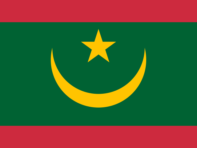
On green, red stripes run along top and bottom edges; a five-pointed yellow star is centered over a yellow, upward-pointing crescent moon. The crescent, star, and green are traditional symbols of Islam; green represents hope for a bright future. Yellow stands for the Sahara's sands, and red for blood shed in the fight for independence. The national symbol is a five-pointed star between the horns of a horizontal crescent moon.
Source: CIA World Factbook · 2026-02-01 · text generated from this source, approved by a person
CIA World Factbook
Values from the CIA World Factbook archive. Each carries the year it describes; open a year for the exact source field.
Natural Earth outlines · features with a Wikidata ID
Population · Natural Earth