Overview
Name
One part of the name refers to the Guinea region of West Africa along the Gulf of Guinea; the name itself derives from the Tuareg word "aginaw," meaning "black people." Bissau, the capital city's name, distinguishes the country from neighboring Guinea and derives from the local Bijuga people.
Source: CIA World Factbook · 2026-02-01 · text generated from this source, approved by a person
Background
For much of its history, the Mali Empire and the Kaabu Kingdom controlled Guinea-Bissau; Portugal established shoreline trading posts in the 16th century. From the 18th century, the Mali Empire and Kingdom of Kaabu disintegrated into smaller entities; Portugal incorporated Guinea-Bissau by the 19th century. Since independence in 1974, Guinea-Bissau has experienced considerable political and military upheaval.
A 1980 military coup made General Joao Bernardo 'Nino' Vieira president; his regime suppressed opposition and purged rivals. Several coup attempts through the 1980s and early 1990s failed, but mutiny and civil war ousted him in 1999. In 2000, a transitional government gave power to Kumba Yala; a bloodless coup installed Henrique Rosa as interim president in 2003. Vieira returned through reelection in 2005 and was assassinated in 2009. Malam Bacai Sanha became president but died in 2012 from a long-term illness; a coup blocked the replacement election's second round, and mediation brought a civilian transitional government to power. Jose Mario Vaz won a free and fair election in 2014 and became the first president to complete a full term in 2019. Umaro Sissoco Embalo was elected president in 2019 but took office in 2020 after a prolonged challenge to the election results.
Source: CIA World Factbook · 2026-02-01 · text generated from this source, approved by a person
Geography
Between Guinea and Senegal, the country borders the North Atlantic Ocean in Western Africa. Its mostly low-lying coastal plain has a deeply indented estuarine coastline and rises to savanna in the east. The country is swampy along its western coast and low-lying inland. Numerous offshore islands include the Arquipelago Dos Bijagos, consisting of main islands and many small islets.
Natural resources include fish, timber, phosphates, bauxite, clay, granite, limestone, and unexploited deposits of petroleum. Dongol Ronde is the country's highest point. The Atlantic Ocean is the country's lowest point.
Source: CIA World Factbook · 2026-02-01 · text generated from this source, approved by a person
Government
Its government is a semi-presidential republic. The legal system is a mixed system of civil law that incorporated Portuguese law at independence. It is influenced by Economic Community of West African States (ECOWAS), West African Economic and Monetary Union (UEMOA), African Francophone Public Law, and customary law. The constitution was promulgated 16 May 1984. The independence dates are 24 September 1973 (declared) and 10 September 1974 (from Portugal). The national holiday is Independence Day, 24 September (1973).
Source: CIA World Factbook · 2026-02-01 · text generated from this source, approved by a person
Flag and symbols
Two equal horizontal bands of yellow over green form the flag; a vertical red band on the left holds a five-pointed black star at its center. Yellow stands for the sun, green for hope, and red for blood shed in the struggle for independence. The black star, a national symbol, stands for African unity. The design uses the colors of the Pan-African movement and was heavily influenced by the Ghanaian flag.
Source: CIA World Factbook · 2026-02-01 · text generated from this source, approved by a person
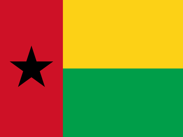 Guinea-Bissau