3 cities

Location of EstoniaÅlandSwedenFinlandBelarusLatviaLithuaniaEstoniaTartuNarvaTallinn
Country

Estonia

58.72° N, 25.87° E

For every 7.86 per 1,000 births there are 12.57 per 1,000 deaths — the population is falling 0.47% a year.

population growth -0.47% · 210th/230 · birth rate 7.86 per 1,000 · 206th/226 · death rate 12.57 per 1,000 · 13th/226
CIA World Factbook · 2026-02-01 · ranks computed across the countries in this atlas that carry the value

Population
1,326,590
Area
45,228 km²
Population density
≈ 29 / km²
Capital
Tallinn
Natural Earth
ISO codes
EE · EST
GDP (nominal)
$42.77 billion
GDP per capita (PPP)
$41,500
How big, reallyDrawn at the same scale as Bhutan — the next country down in size. Equal-area projection, not the map you are used to.
Estonia 45,228 km²Bhutan 38,394 km²

geometry: Natural Earth 1:50m · EPSG:6933 equal-area

Where Estonia sits in the world

Each line is every country in this atlas that carries the value, ordered smallest to largest. The line down the middle is the world median; the mark on each line is this country.

  1. Median age42.9 years40th of 224 · median 32.6 years
  2. Life expectancy78.4 years78th of 224 · median 76.2 years
  3. Fertility rate1.36 children per woman200th of 225 · median 1.92 children per woman
  4. Population1,326,590157th of 235 · median 5,454,073
  5. Total area45,228 km²131st of 228 · median 83,736 km²
  6. Coastline3,794 km32nd of 229 · median 402 km

Overview

Name

The name derives from the people who lived along the eastern Baltic Sea in the first centuries CE; their name came from the Baltic word "aueist," meaning "waterside dwellers."

Source: CIA World Factbook · 2026-02-01 · text generated from this source, approved by a person

Background

After centuries of Danish, Swedish, German, and Russian rule, Estonia attained independence in 1918. Estonia was forcibly incorporated into the USSR in 1940, an action never recognized by the US and many other countries. It regained its freedom in 1991 with the collapse of the Soviet Union.

Since the last Russian troops left in 1994, Estonia has been free to promote economic and political ties with the West. It joined both NATO and the EU in 2004, formally joined the OECD in 2010, and adopted the euro as its official currency in 2011.

Source: CIA World Factbook · 2026-02-01 · text generated from this source, approved by a person

Geography

Marshy lowlands shape Estonia’s terrain, with flat ground in the north and hills in the south. The mainland terrain is flat, boggy, and partly wooded, while islands lie offshore. Estonia lies in Eastern Europe, bordering the Baltic Sea and Gulf of Finland between Latvia and Russia.

Its natural resources include oil shale, peat, rare earth elements, phosphorite, clay, limestone, sand, dolomite, arable land, and sea mud. Suur Munamagi is Estonia’s highest point. The Baltic Sea is Estonia’s lowest point.

Source: CIA World Factbook · 2026-02-01 · text generated from this source, approved by a person

Climate

The climate is maritime, with wet conditions, moderate winters, and cool summers. Flooding sometimes occurs in spring.

Source: CIA World Factbook · 2026-02-01 · text generated from this source, approved by a person

Flag and symbols

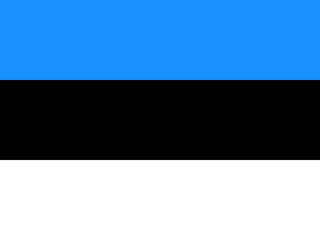
The flag has three equal horizontal bands: blue on top, then black and white. Blue stands for faith, loyalty, and devotion, and also the sky, sea, and lakes. Black stands for the country's soil and the Estonian people's past suffering; white, for striving for enlightenment and virtue, birch bark, snow, and summer nights illuminated by the midnight sun. The national symbols are the barn swallow and cornflower.

Source: CIA World Factbook · 2026-02-01 · text generated from this source, approved by a person
Key figures

CIA World Factbook

Economy

GDP (nominal)
$42.77 billion
GDP (PPP)
$57 billion
GDP per capita (PPP)
$41,500
GDP growth
-0.3%
Inflation (consumer prices)
3.5%
Unemployment
7.9%
Exports
$32.64 billion
Imports
$32.38 billion

People

Life expectancy
78.4 years
Median age
42.9 years
Birth rate
7.86 per 1,000
Death rate
12.57 per 1,000
Fertility rate
1.36 children per woman
Population growth
-0.47% a year
Urban population
69.8%
Languages
  • Estonianofficial67.2%
  • Russian28.5%
  • others0.6%
Religions
  • Orthodox16.5%
  • Protestant9.2%Lutheran 7.7%, other Protestant 1.5%
  • other12.9%

Land

Total area
45,228 km²Land 42,388 km² · Water 2,840 km²
Coastline
3,794 km
Land borders
657 km
Mean elevation
61 m
Highest point
318 m Suur Munamagi

Values from the CIA World Factbook archive. Each carries the year it describes; open a year for the exact source field.

Connections

Natural geography 7

Natural Earth outlines · features with a Wikidata ID

Islands 1

Largest cities 3

Population · Natural Earth

  1. Tallinncapital394K
  2. Tartu101.1K
  3. Narva67K

Sources