Field “Economy → GDP (official exchange rate)” in the CIA World Factbook archive (frozen 2026-02-01). Public domain. The Factbook stopped publishing in February 2026; the year shows when the value was estimated.
GDP per capita (PPP)
$700
Field “Economy → Real GDP per capita → Real GDP per capita 2024” in the CIA World Factbook archive (frozen 2026-02-01). Public domain. The Factbook stopped publishing in February 2026; the year shows when the value was estimated.
Each line is every country in this atlas that carries the value, ordered smallest to largest. The line down the middle is the world median; the mark on each line is this country.
median
Median age21.7 years186th of 224 · median 32.6 years
Life expectancy67.5 years194th of 224 · median 76.2 years
Fertility rate3.35 children per woman39th of 225 · median 1.92 children per woman
Population6,081,196113th of 235 · median 5,454,073
Total area117,600 km²101st of 228 · median 83,736 km²
Coastline2,234 km57th of 229 · median 402 km
Overview
Name
The name Eritrea derives from the ancient Greek name "Erythra Thalassa," meaning "Red Sea," the body of water that borders the country. Its conventional long form is State of Eritrea.
Source: CIA World Factbook · 2026-02-01 · text generated from this source, approved by a person
Climate
A hot, dry desert strip runs along the Red Sea coast, while the central highlands are cooler and wetter. Rainfall in the central highlands is heaviest from June to September, while the western hills and lowlands are semiarid.
Source: CIA World Factbook · 2026-02-01 · text generated from this source, approved by a person
People and society
Its ethnic groups include Tigrinya, Tigre, Saho, Afar, Kunama, Bilen, Hedareb/Beja, Nara, and Rashaida. Religions include Eritrean Orthodox, Roman Catholic, Evangelical Lutheran, and Sunni Muslim.
Population density is highest in the center, in and around Asmara, the capital, and Keren. Smaller settlements exist in the north and south.
Source: CIA World Factbook · 2026-02-01 · text generated from this source, approved by a person
Government
The government is authoritarian. Its legal system is a mixed system of civil, customary, and Islamic religious law. The constitution was ratified by the Constituent Assembly 23 May 1997 but never implemented. The country gained independence from Ethiopia on 24 May 1993. Its national holiday is Independence Day, 24 May (1991).
Source: CIA World Factbook · 2026-02-01 · text generated from this source, approved by a person
Key figures
CIA World Factbook
Economy
GDP (nominal)
$2.54 billion
Field “Economy → GDP (official exchange rate)” in the CIA World Factbook archive (frozen 2026-02-01). Public domain. The Factbook stopped publishing in February 2026; the year shows when the value was estimated.
GDP (PPP)
$2.53 billion
Field “Economy → Real GDP (purchasing power parity) → Real GDP (purchasing power parity) 2024” in the CIA World Factbook archive (frozen 2026-02-01). Public domain. The Factbook stopped publishing in February 2026; the year shows when the value was estimated.
GDP per capita (PPP)
$700
Field “Economy → Real GDP per capita → Real GDP per capita 2024” in the CIA World Factbook archive (frozen 2026-02-01). Public domain. The Factbook stopped publishing in February 2026; the year shows when the value was estimated.
GDP growth
+5%
Field “Economy → Real GDP growth rate → Real GDP growth rate 2017” in the CIA World Factbook archive (frozen 2026-02-01). Public domain. The Factbook stopped publishing in February 2026; the year shows when the value was estimated.
Inflation (consumer prices)
7.4%
Field “Economy → Inflation rate (consumer prices) → Inflation rate (consumer prices) 2022” in the CIA World Factbook archive (frozen 2026-02-01). Public domain. The Factbook stopped publishing in February 2026; the year shows when the value was estimated.
Unemployment
5.6%
Field “Economy → Unemployment rate → Unemployment rate 2024” in the CIA World Factbook archive (frozen 2026-02-01). Public domain. The Factbook stopped publishing in February 2026; the year shows when the value was estimated.
Exports
$624.3 million
Field “Economy → Exports → Exports 2017” in the CIA World Factbook archive (frozen 2026-02-01). Public domain. The Factbook stopped publishing in February 2026; the year shows when the value was estimated.
Imports
$494.23 million
Field “Economy → Imports → Imports 2010” in the CIA World Factbook archive (frozen 2026-02-01). Public domain. The Factbook stopped publishing in February 2026; the year shows when the value was estimated.
People
Life expectancy
67.5 years
Field “People and Society → Life expectancy at birth → total population” in the CIA World Factbook archive (frozen 2026-02-01). Public domain. The Factbook stopped publishing in February 2026; the year shows when the value was estimated.
Median age
21.7 years
Field “People and Society → Median age → total” in the CIA World Factbook archive (frozen 2026-02-01). Public domain. The Factbook stopped publishing in February 2026; the year shows when the value was estimated.
Birth rate
25.92 per 1,000
Field “People and Society → Birth rate” in the CIA World Factbook archive (frozen 2026-02-01). Public domain. The Factbook stopped publishing in February 2026; the year shows when the value was estimated.
Death rate
6.43 per 1,000
Field “People and Society → Death rate” in the CIA World Factbook archive (frozen 2026-02-01). Public domain. The Factbook stopped publishing in February 2026; the year shows when the value was estimated.
Fertility rate
3.35 children per woman
Field “People and Society → Total fertility rate” in the CIA World Factbook archive (frozen 2026-02-01). Public domain. The Factbook stopped publishing in February 2026; the year shows when the value was estimated.
Population growth
+1.16% a year
Field “People and Society → Population growth rate” in the CIA World Factbook archive (frozen 2026-02-01). Public domain. The Factbook stopped publishing in February 2026; the year shows when the value was estimated.
Urban population
43.3%
Field “People and Society → Urbanization → urban population” in the CIA World Factbook archive (frozen 2026-02-01). Public domain. The Factbook stopped publishing in February 2026; the year shows when the value was estimated.
Languages
Tigrinyaofficial
Arabicofficial
Englishofficial
Tigre
Kunama
Afar
others
Field “People and Society → Languages” in the CIA World Factbook archive (frozen 2026-02-01). Public domain. The Factbook stopped publishing in February 2026; the year shows when the value was estimated.
Religions
Eritrean Orthodox
Roman Catholic
Evangelical Lutheran
Sunni Muslim
Field “People and Society → Religions” in the CIA World Factbook archive (frozen 2026-02-01). Public domain. The Factbook stopped publishing in February 2026; the year shows when the value was estimated.
Land
Total area
117,600 km²Land 101,000 km² · Water 16,600 km²
Field “Geography → Area → total” in the CIA World Factbook archive (frozen 2026-02-01). Public domain. The Factbook stopped publishing in February 2026; the year shows when the value was estimated.
Coastline
2,234 km
Field “Geography → Coastline” in the CIA World Factbook archive (frozen 2026-02-01). Public domain. The Factbook stopped publishing in February 2026; the year shows when the value was estimated.
Land borders
1,840 km
Field “Geography → Land boundaries → total” in the CIA World Factbook archive (frozen 2026-02-01). Public domain. The Factbook stopped publishing in February 2026; the year shows when the value was estimated.
Mean elevation
853 m
Field “Geography → Elevation → mean elevation” in the CIA World Factbook archive (frozen 2026-02-01). Public domain. The Factbook stopped publishing in February 2026; the year shows when the value was estimated.
Highest point
3,018 m Soira
Field “Geography → Elevation → highest point” in the CIA World Factbook archive (frozen 2026-02-01). Public domain. The Factbook stopped publishing in February 2026; the year shows when the value was estimated.
Values from the CIA World Factbook archive. Each carries the year it describes; open a year for the exact source field.
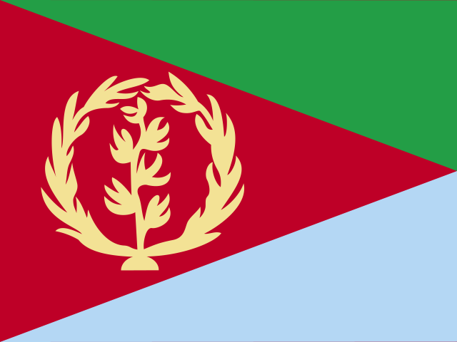 Eritrea