4 cities

Location of CongoEquatorial GuineaDemocratic Republic of the CongoSouth SudanCentral African RepublicGabonTogoUgandaSudanAngolaBurkina FasoBeninBurundiNigeriaRwandaTanzaniaGhanaCameroonCôte d'IvoireNigerSão Tomé and PrincipeZambiaChadCongoBrazzavilleKayesPointe-NoireLoubomo
Country

Congo

Republic of the Congo · local name

0.14° N, 15.90° E

5,554 km of land border against just 169 km of coast — this country faces its neighbors far more than it faces the sea.

coastline 169 km · 142nd/229 · land borders 5,554 km · 31st/230
CIA World Factbook · 2026-02-01 · ranks computed across the countries in this atlas that carry the value

Population
5,380,508
Area
342,000 km²
Population density
≈ 16 / km²
Capital
Brazzaville
Natural Earth
ISO codes
CG · COG
GDP (nominal)
$15.72 billion
GDP per capita (PPP)
$6,200
How big, reallyDrawn at the same scale as Burkina Faso — the next country down in size. Equal-area projection, not the map you are used to.
Congo 342,000 km²Burkina Faso 274,200 km²

geometry: Natural Earth 1:50m · EPSG:6933 equal-area

Where Congo sits in the world

Each line is every country in this atlas that carries the value, ordered smallest to largest. The line down the middle is the world median; the mark on each line is this country.

  1. Median age20.9 years192nd of 224 · median 32.6 years
  2. Life expectancy72.9 years153rd of 224 · median 76.2 years
  3. Fertility rate3.72 children per woman28th of 225 · median 1.92 children per woman
  4. Population5,380,508119th of 235 · median 5,454,073
  5. Total area342,000 km²64th of 228 · median 83,736 km²
  6. Coastline169 km142nd of 229 · median 402 km

Overview

Name

The name comes from the Congo River, which makes up much of the country's eastern border. The river's name derives from "Kongo," a Bantu kingdom in the area.

Source: CIA World Factbook · 2026-02-01 · text generated from this source, approved by a person

Background

Upon independence in 1960, the former French region of Middle Congo became the Republic of the Congo. From 1968 to 1992, the country was named the People’s Republic of the Congo. The country abandoned Marxism in 1990, and a democratically elected government took office in 1992, when the country reverted to the name Republic of the Congo. A civil war that ended in 1999 restored former President Denis Sassou-Nguesso to power, after he had ruled from 1979 to 1992.

A new constitution provided for a multi-party system and a presidential term, and the next elections retained Sassou-Nguesso. After renewed fighting, Sassou-Nguesso and southern-based rebel groups agreed to a final peace accord in 2003. Following a constitutional referendum allowing him to run for additional terms, Sassou-Nguesso was reelected in 2009 and again in 2016 and 2021. The Republic of the Congo is a petroleum producer in Africa.

Source: CIA World Factbook · 2026-02-01 · text generated from this source, approved by a person

Climate

Astride the Equator, Congo has a tropical climate with persistent high temperatures and humidity, making it particularly enervating. Its rainy season runs from March to June, while the dry season extends from June to October.

Source: CIA World Factbook · 2026-02-01 · text generated from this source, approved by a person

People and society

The population includes Kongo (Bakongo), Teke, Mbochi, foreigner, Sangha, Mbere/Mbeti/Kele, and Punu. They also include Pygmy, Oubanguiens, Duma, and Makaa. French is official; French Lingala and Monokutuba are trade languages, alongside many local languages and dialects. Kikongo is the most widespread of the local languages and dialects.

Religious affiliations include Roman Catholic, Awakening Churches/Christian Revival, Protestant, Salutiste, Muslim, and Kimbanguist; some have none. People live primarily in the south, in and around the capital of Brazzaville.

Source: CIA World Factbook · 2026-02-01 · text generated from this source, approved by a person

Flag and symbols

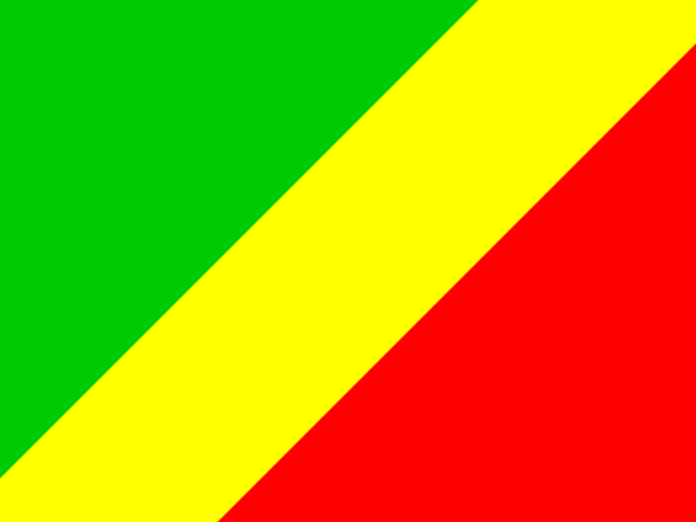
A wide yellow band divides the flag diagonally from the lower-left side; the upper triangle on the left is green, and the lower triangle is red. Green stands for agriculture and forests, while yellow stands for the people's friendship and nobility; the meaning of red is not noted but has been associated with the struggle for independence. The national symbols are the lion and elephant.

Source: CIA World Factbook · 2026-02-01 · text generated from this source, approved by a person
Key figures

CIA World Factbook

Economy

GDP (nominal)
$15.72 billion
GDP (PPP)
$39.15 billion
GDP per capita (PPP)
$6,200
GDP growth
+2.6%
Inflation (consumer prices)
3.1%
Unemployment
19.7%
Exports
$7.75 billion
Imports
$4.49 billion

People

Life expectancy
72.9 years
Median age
20.9 years
Birth rate
28.34 per 1,000
Death rate
4.64 per 1,000
Fertility rate
3.72 children per woman
Population growth
+2.36% a year
Urban population
69.2%
Languages
  • Frenchofficial
  • French Lingala and Monokutuba
  • many local languages and dialects
Religions
  • Roman Catholic33.1%
  • Awakening Churches/Christian Revival22.3%
  • Protestant19.9%
  • Salutiste2.2%
  • Muslim1.6%
  • Kimbanguist1.5%
  • other11.3%

Land

Total area
342,000 km²Land 341,500 km² · Water 500 km²
Coastline
169 km
Land borders
5,554 km
Mean elevation
430 m
Highest point
1,020 m Mont Nabeba

Values from the CIA World Factbook archive. Each carries the year it describes; open a year for the exact source field.

Connections

Natural geography 2

Natural Earth outlines · features with a Wikidata ID

Mountain ranges 1

Largest cities 4

Population · Natural Earth

  1. Brazzavillecapital1.4M
  2. Pointe-Noire659.1K
  3. Loubomo103.9K
  4. Kayes62.5K

Sources