Name
Christopher Columbus named the island Saint Vincent after Saint Vincent of Saragossa because the day of discovery was the saint's feast day.
Source: CIA World Factbook · 2026-02-01 · text generated from this source, approved by a person
 Saint Vincent and the Grenadines
13.25° N, 61.20° W
No land border at all — every neighbor is across water, along 84 km of coast, the 161st longest on Earth.
land borders 0 km · 164th/230 · coastline 84 km · 161st/229
CIA World Factbook · 2026-02-01 · ranks computed across the countries in this atlas that carry the value
geometry: Natural Earth 1:50m · EPSG:6933 equal-area
Each line is every country in this atlas that carries the value, ordered smallest to largest. The line down the middle is the world median; the mark on each line is this country.
Christopher Columbus named the island Saint Vincent after Saint Vincent of Saragossa because the day of discovery was the saint's feast day.
Source: CIA World Factbook · 2026-02-01 · text generated from this source, approved by a person
Its tropical climate brings little seasonal temperature variation and a rainy season from May to November.
Source: CIA World Factbook · 2026-02-01 · text generated from this source, approved by a person
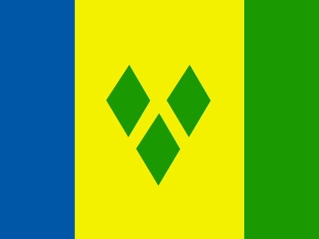
Three vertical bands mark the flag: blue on the left, a double-width gold center, and green on the right, with three green diamonds in a "V" pattern on the gold band. The diamonds represent the islands as "the Gems of the Antilles" and sit slightly lowered to reflect the country's position in the Antilles; blue stands for tropical sky and sea, yellow for sand, and green for vegetation. The national symbol is the Saint Vincent parrot.
Source: CIA World Factbook · 2026-02-01 · text generated from this source, approved by a person
CIA World Factbook
Values from the CIA World Factbook archive. Each carries the year it describes; open a year for the exact source field.
Natural Earth outlines · features with a Wikidata ID
Population · Natural Earth