Field “Economy → GDP (official exchange rate)” in the CIA World Factbook archive (frozen 2026-02-01). Public domain. The Factbook stopped publishing in February 2026; the year shows when the value was estimated.
GDP per capita (PPP)
$1,400
Field “Economy → Real GDP per capita → Real GDP per capita 2024” in the CIA World Factbook archive (frozen 2026-02-01). Public domain. The Factbook stopped publishing in February 2026; the year shows when the value was estimated.
Each line is every country in this atlas that carries the value, ordered smallest to largest. The line down the middle is the world median; the mark on each line is this country.
median
Median age15.7 years223rd of 224 · median 32.6 years
Life expectancy56.5 years222nd of 224 · median 76.2 years
Fertility rate6.38 children per woman2nd of 225 · median 1.92 children per woman
Population10,192,31789th of 235 · median 5,454,073
Total area637,657 km²45th of 228 · median 83,736 km²
Coastline3,025 km39th of 229 · median 402 km
Overview
Geography
Somalia lies in Eastern Africa, bordering the Gulf of Aden and the Indian Ocean east of Ethiopia. Its strategic location on the Horn of Africa lies along the southern approaches to Bab el Mandeb and the route through the Red Sea and Suez Canal. The land is mostly a flat to undulating plateau, rising to hills in the north.
Somalia has uranium and largely unexploited reserves of iron ore, tin, gypsum, bauxite, copper, salt, and natural gas, along with likely oil reserves. Mount Shimbiris is the highest point. The Indian Ocean is the lowest point.
Source: CIA World Factbook · 2026-02-01 · text generated from this source, approved by a person
Government
A federal parliamentary republic governs Somalia. Its mixed legal system combines civil law, Islamic (sharia) law, and customary law referred to as Xeer. The latest constitution was drafted 12 June 2012 and adopted 1 August 2012. Independence came on 1 July 1960 through the merger of British Somaliland and Italian Somaliland to form the Somali Republic. The national holiday marks the Foundation of the Somali Republic on 1 July (1960), with 26 June (1960) noted in Somaliland.
Source: CIA World Factbook · 2026-02-01 · text generated from this source, approved by a person
Key figures
CIA World Factbook
Economy
GDP (nominal)
$12.11 billion
Field “Economy → GDP (official exchange rate)” in the CIA World Factbook archive (frozen 2026-02-01). Public domain. The Factbook stopped publishing in February 2026; the year shows when the value was estimated.
GDP (PPP)
$26.77 billion
Field “Economy → Real GDP (purchasing power parity) → Real GDP (purchasing power parity) 2024” in the CIA World Factbook archive (frozen 2026-02-01). Public domain. The Factbook stopped publishing in February 2026; the year shows when the value was estimated.
GDP per capita (PPP)
$1,400
Field “Economy → Real GDP per capita → Real GDP per capita 2024” in the CIA World Factbook archive (frozen 2026-02-01). Public domain. The Factbook stopped publishing in February 2026; the year shows when the value was estimated.
GDP growth
+4%
Field “Economy → Real GDP growth rate → Real GDP growth rate 2024” in the CIA World Factbook archive (frozen 2026-02-01). Public domain. The Factbook stopped publishing in February 2026; the year shows when the value was estimated.
Inflation (consumer prices)
6.8%
Field “Economy → Inflation rate (consumer prices) → Inflation rate (consumer prices) 2022” in the CIA World Factbook archive (frozen 2026-02-01). Public domain. The Factbook stopped publishing in February 2026; the year shows when the value was estimated.
Unemployment
18.9%
Field “Economy → Unemployment rate → Unemployment rate 2024” in the CIA World Factbook archive (frozen 2026-02-01). Public domain. The Factbook stopped publishing in February 2026; the year shows when the value was estimated.
Exports
$2.42 billion
Field “Economy → Exports → Exports 2024” in the CIA World Factbook archive (frozen 2026-02-01). Public domain. The Factbook stopped publishing in February 2026; the year shows when the value was estimated.
Imports
$9 billion
Field “Economy → Imports → Imports 2024” in the CIA World Factbook archive (frozen 2026-02-01). Public domain. The Factbook stopped publishing in February 2026; the year shows when the value was estimated.
People
Life expectancy
56.5 years
Field “People and Society → Life expectancy at birth → total population” in the CIA World Factbook archive (frozen 2026-02-01). Public domain. The Factbook stopped publishing in February 2026; the year shows when the value was estimated.
Median age
15.7 years
Field “People and Society → Median age → total” in the CIA World Factbook archive (frozen 2026-02-01). Public domain. The Factbook stopped publishing in February 2026; the year shows when the value was estimated.
Birth rate
46.36 per 1,000
Field “People and Society → Birth rate” in the CIA World Factbook archive (frozen 2026-02-01). Public domain. The Factbook stopped publishing in February 2026; the year shows when the value was estimated.
Death rate
11.22 per 1,000
Field “People and Society → Death rate” in the CIA World Factbook archive (frozen 2026-02-01). Public domain. The Factbook stopped publishing in February 2026; the year shows when the value was estimated.
Fertility rate
6.38 children per woman
Field “People and Society → Total fertility rate” in the CIA World Factbook archive (frozen 2026-02-01). Public domain. The Factbook stopped publishing in February 2026; the year shows when the value was estimated.
Population growth
+3.32% a year
Field “People and Society → Population growth rate” in the CIA World Factbook archive (frozen 2026-02-01). Public domain. The Factbook stopped publishing in February 2026; the year shows when the value was estimated.
Urban population
47.9%
Field “People and Society → Urbanization → urban population” in the CIA World Factbook archive (frozen 2026-02-01). Public domain. The Factbook stopped publishing in February 2026; the year shows when the value was estimated.
Literacy
54.1%
Field “People and Society → Literacy → total population” in the CIA World Factbook archive (frozen 2026-02-01). Public domain. The Factbook stopped publishing in February 2026; the year shows when the value was estimated.
Languages
Somaliofficial
Arabicofficial
Italian
English
Field “People and Society → Languages → Languages” in the CIA World Factbook archive (frozen 2026-02-01). Public domain. The Factbook stopped publishing in February 2026; the year shows when the value was estimated.
Religions
Muslim99.9%Sunni Muslim 98.1%, Shia Muslim 1.2%, Islamic schismatic 0.6%
ethnic religionist0.1%
Field “People and Society → Religions” in the CIA World Factbook archive (frozen 2026-02-01). Public domain. The Factbook stopped publishing in February 2026; the year shows when the value was estimated.
Land
Total area
637,657 km²Land 627,337 km² · Water 10,320 km²
Field “Geography → Area → total” in the CIA World Factbook archive (frozen 2026-02-01). Public domain. The Factbook stopped publishing in February 2026; the year shows when the value was estimated.
Coastline
3,025 km
Field “Geography → Coastline” in the CIA World Factbook archive (frozen 2026-02-01). Public domain. The Factbook stopped publishing in February 2026; the year shows when the value was estimated.
Land borders
2,385 km
Field “Geography → Land boundaries → total” in the CIA World Factbook archive (frozen 2026-02-01). Public domain. The Factbook stopped publishing in February 2026; the year shows when the value was estimated.
Mean elevation
410 m
Field “Geography → Elevation → mean elevation” in the CIA World Factbook archive (frozen 2026-02-01). Public domain. The Factbook stopped publishing in February 2026; the year shows when the value was estimated.
Highest point
2,460 m Mount Shimbiris
Field “Geography → Elevation → highest point” in the CIA World Factbook archive (frozen 2026-02-01). Public domain. The Factbook stopped publishing in February 2026; the year shows when the value was estimated.
Values from the CIA World Factbook archive. Each carries the year it describes; open a year for the exact source field.
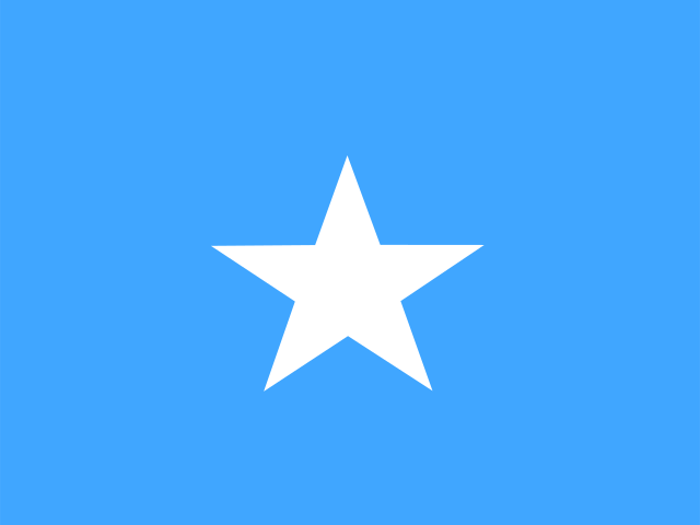 Somalia