Climate
Mostly hot, dry desert conditions characterize Pakistan, while the northwest is temperate and the north arctic.
Source: CIA World Factbook · 2026-02-01 · text generated from this source, approved by a person
 Pakistan
29.33° N, 68.55° E
216,565,318 people live here — the 5th largest population on Earth.
population 216,565,318 · 5th/235
Natural Earth · ranks computed across the countries in this atlas that carry the value
geometry: Natural Earth 1:50m · EPSG:6933 equal-area
Each line is every country in this atlas that carries the value, ordered smallest to largest. The line down the middle is the world median; the mark on each line is this country.
Mostly hot, dry desert conditions characterize Pakistan, while the northwest is temperate and the north arctic.
Source: CIA World Factbook · 2026-02-01 · text generated from this source, approved by a person
The Indus River and its tributaries attract most of the settlement, with Punjab province the most densely populated. Its ethnic groups include Punjabi, Pashtun (Pathan), Sindhi, Saraiki, Muhajirs, and Baloch.
The languages spoken include Punjabi, Pashto (also called Pashtu), Sindhi, Saraiki, a Punjabi variant, Urdu, Balochi, Hindko, and Brahui, as well as other languages. Religious affiliations include Muslim, Hindu, Christian, scheduled castes, Qadiani/Ahmadi, and Sikh.
Source: CIA World Factbook · 2026-02-01 · text generated from this source, approved by a person
A federal parliamentary republic governs Pakistan. Its legal system is a common law system with Islamic law influence. The latest constitution was endorsed 12 April 1973, passed 19 April 1973, and entered into force 14 August 1973; it was suspended and restored several times. Independence came 14 August 1947 from British India. The national holiday is Pakistan Day, 23 March, also referred to as Pakistan Resolution Day (1940) or Republic Day (1956).
Source: CIA World Factbook · 2026-02-01 · text generated from this source, approved by a person
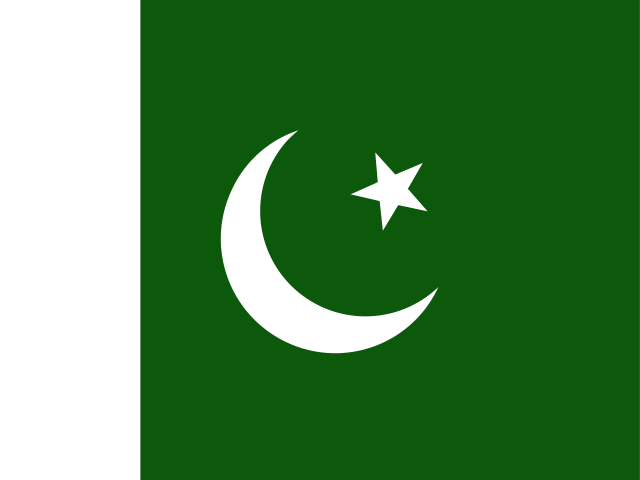
A green field has a vertical white band on the left side, with a large white crescent and star centered in the green field. The crescent, star, and color green are all traditional Islamic symbols, while the white band symbolizes the role of religious minorities. National symbols include a five-pointed star between the horns of a waxing crescent moon, and jasmine.
Source: CIA World Factbook · 2026-02-01 · text generated from this source, approved by a person
CIA World Factbook
Values from the CIA World Factbook archive. Each carries the year it describes; open a year for the exact source field.
Natural Earth outlines · features with a Wikidata ID
Population · Natural Earth