Field “Economy → GDP (official exchange rate)” in the CIA World Factbook archive (frozen 2026-02-01). Public domain. The Factbook stopped publishing in February 2026; the year shows when the value was estimated.
GDP per capita (PPP)
$9,100
Field “Economy → Real GDP per capita → Real GDP per capita 2024” in the CIA World Factbook archive (frozen 2026-02-01). Public domain. The Factbook stopped publishing in February 2026; the year shows when the value was estimated.
Each line is every country in this atlas that carries the value, ordered smallest to largest. The line down the middle is the world median; the mark on each line is this country.
median
Median age30.9 years130th of 224 · median 32.6 years
Life expectancy74.2 years142nd of 224 · median 76.2 years
Fertility rate2.24 children per woman78th of 225 · median 1.92 children per woman
Population36,471,76940th of 235 · median 5,454,073
Total area716,550 km²41st of 228 · median 83,736 km²
Coastline2,945 km40th of 229 · median 402 km
Overview
Geography
With Atlantic and Mediterranean coastlines, Morocco is the only African nation with both and has a strategic location along the Strait of Gibraltar. Between Algeria and Mauritania, it borders the North Atlantic Ocean and the Mediterranean Sea in Northern Africa. Large plateaus, intermontane valleys, and fertile coastal plains border the mountainous northern coast and interior, which include the Rif Mountains and Atlas Mountains. Southward, the terrain is mostly low, flat desert with large areas of rocky or sandy surfaces.
Its natural resources include phosphates, iron ore, manganese, lead, zinc, fish, and salt. Waters off the Atlantic coast are particularly rich fishing areas.
Source: CIA World Factbook · 2026-02-01 · text generated from this source, approved by a person
Climate
Mediterranean climate in the north becomes more extreme in the interior, while the south has hot, dry desert conditions. Rain is rare, while cold offshore air currents produce fog and heavy dew. During winter and spring, a hot, dry, dust/sand-laden sirocco wind can occur in the south.
Source: CIA World Factbook · 2026-02-01 · text generated from this source, approved by a person
Government
A parliamentary constitutional monarchy governs Morocco. Its mixed legal system is based on French civil law and Islamic (sharia) law, and the Constitutional Court reviews legislative acts. The latest constitution was drafted 17 June 2011 and approved by referendum 1 July 2011. Morocco gained independence from France on 2 March 1956. Throne Day, 30 July, marks the accession of King Mohammed VI to the throne in 1999.
Source: CIA World Factbook · 2026-02-01 · text generated from this source, approved by a person
Flag and symbols
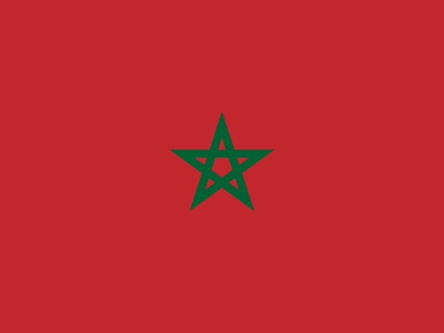
A red flag bears a green pentacle—a five-pointed linear star known as Sulayman's (Solomon's) seal—in its center. Red and green are traditional colors in Arab flags; red is more commonly associated with the Arab states of the Persian Gulf, while the pentacle represents the five pillars of Islam and the association between God and the nation. The design dates to 1912. The national symbols are the pentacle symbol and lion.
Source: CIA World Factbook · 2026-02-01 · text generated from this source, approved by a person
Key figures
CIA World Factbook
Economy
GDP (nominal)
$154.43 billion
Field “Economy → GDP (official exchange rate)” in the CIA World Factbook archive (frozen 2026-02-01). Public domain. The Factbook stopped publishing in February 2026; the year shows when the value was estimated.
GDP (PPP)
$350.59 billion
Field “Economy → Real GDP (purchasing power parity) → Real GDP (purchasing power parity) 2024” in the CIA World Factbook archive (frozen 2026-02-01). Public domain. The Factbook stopped publishing in February 2026; the year shows when the value was estimated.
GDP per capita (PPP)
$9,100
Field “Economy → Real GDP per capita → Real GDP per capita 2024” in the CIA World Factbook archive (frozen 2026-02-01). Public domain. The Factbook stopped publishing in February 2026; the year shows when the value was estimated.
GDP growth
+3.2%
Field “Economy → Real GDP growth rate → Real GDP growth rate 2024” in the CIA World Factbook archive (frozen 2026-02-01). Public domain. The Factbook stopped publishing in February 2026; the year shows when the value was estimated.
Inflation (consumer prices)
1%
Field “Economy → Inflation rate (consumer prices) → Inflation rate (consumer prices) 2024” in the CIA World Factbook archive (frozen 2026-02-01). Public domain. The Factbook stopped publishing in February 2026; the year shows when the value was estimated.
Unemployment
9%
Field “Economy → Unemployment rate → Unemployment rate 2024” in the CIA World Factbook archive (frozen 2026-02-01). Public domain. The Factbook stopped publishing in February 2026; the year shows when the value was estimated.
Exports
$61.75 billion
Field “Economy → Exports → Exports 2023” in the CIA World Factbook archive (frozen 2026-02-01). Public domain. The Factbook stopped publishing in February 2026; the year shows when the value was estimated.
Imports
$73.76 billion
Field “Economy → Imports → Imports 2023” in the CIA World Factbook archive (frozen 2026-02-01). Public domain. The Factbook stopped publishing in February 2026; the year shows when the value was estimated.
People
Life expectancy
74.2 years
Field “People and Society → Life expectancy at birth → total population” in the CIA World Factbook archive (frozen 2026-02-01). Public domain. The Factbook stopped publishing in February 2026; the year shows when the value was estimated.
Median age
30.9 years
Field “People and Society → Median age → total” in the CIA World Factbook archive (frozen 2026-02-01). Public domain. The Factbook stopped publishing in February 2026; the year shows when the value was estimated.
Birth rate
16.5 per 1,000
Field “People and Society → Birth rate” in the CIA World Factbook archive (frozen 2026-02-01). Public domain. The Factbook stopped publishing in February 2026; the year shows when the value was estimated.
Death rate
6.66 per 1,000
Field “People and Society → Death rate” in the CIA World Factbook archive (frozen 2026-02-01). Public domain. The Factbook stopped publishing in February 2026; the year shows when the value was estimated.
Fertility rate
2.24 children per woman
Field “People and Society → Total fertility rate” in the CIA World Factbook archive (frozen 2026-02-01). Public domain. The Factbook stopped publishing in February 2026; the year shows when the value was estimated.
Population growth
+0.81% a year
Field “People and Society → Population growth rate” in the CIA World Factbook archive (frozen 2026-02-01). Public domain. The Factbook stopped publishing in February 2026; the year shows when the value was estimated.
Urban population
65.1%
Field “People and Society → Urbanization → urban population” in the CIA World Factbook archive (frozen 2026-02-01). Public domain. The Factbook stopped publishing in February 2026; the year shows when the value was estimated.
Languages
Arabicofficial
Tamazight languages , Tachelhit, Tarifit)
French
Field “People and Society → Languages → Languages” in the CIA World Factbook archive (frozen 2026-02-01). Public domain. The Factbook stopped publishing in February 2026; the year shows when the value was estimated.
Land
Total area
716,550 km²Land 716,300 km² · Water 250 km²
Field “Geography → Area → total” in the CIA World Factbook archive (frozen 2026-02-01). Public domain. The Factbook stopped publishing in February 2026; the year shows when the value was estimated.
Coastline
2,945 km
Field “Geography → Coastline” in the CIA World Factbook archive (frozen 2026-02-01). Public domain. The Factbook stopped publishing in February 2026; the year shows when the value was estimated.
Land borders
3,524 km
Field “Geography → Land boundaries → total” in the CIA World Factbook archive (frozen 2026-02-01). Public domain. The Factbook stopped publishing in February 2026; the year shows when the value was estimated.
Mean elevation
909 m
Field “Geography → Elevation → mean elevation” in the CIA World Factbook archive (frozen 2026-02-01). Public domain. The Factbook stopped publishing in February 2026; the year shows when the value was estimated.
Highest point
4,165 m Jebel Toubkal
Field “Geography → Elevation → highest point” in the CIA World Factbook archive (frozen 2026-02-01). Public domain. The Factbook stopped publishing in February 2026; the year shows when the value was estimated.
Values from the CIA World Factbook archive. Each carries the year it describes; open a year for the exact source field.
 Morocco