Name
The name Jamaica comes from the Arawak word "xaymaca", meaning "Land of Wood and Water" or possibly "Land of Springs".
Source: CIA World Factbook · 2026-02-01 · text generated from this source, approved by a person
 Jamaica
18.14° N, 77.32° W
No land border at all — every neighbor is across water, along 1,022 km of coast, the 83rd longest on Earth.
land borders 0 km · 164th/230 · coastline 1,022 km · 83rd/229
CIA World Factbook · 2026-02-01 · ranks computed across the countries in this atlas that carry the value
geometry: Natural Earth 1:50m · EPSG:6933 equal-area
Each line is every country in this atlas that carries the value, ordered smallest to largest. The line down the middle is the world median; the mark on each line is this country.
The name Jamaica comes from the Arawak word "xaymaca", meaning "Land of Wood and Water" or possibly "Land of Springs".
Source: CIA World Factbook · 2026-02-01 · text generated from this source, approved by a person
South of Cuba, Jamaica is an island in the Caribbean Sea. Jamaica is mostly mountainous, with a narrow, discontinuous coastal plain.
Its strategic location lies between the Cayman Trench and Jamaica Channel, the main sea lanes for the Panama Canal. Jamaica's natural resources include bauxite, alumina, gypsum, and limestone. Blue Mountain Peak is Jamaica's highest point. The Caribbean Sea is Jamaica's lowest point.
Source: CIA World Factbook · 2026-02-01 · text generated from this source, approved by a person
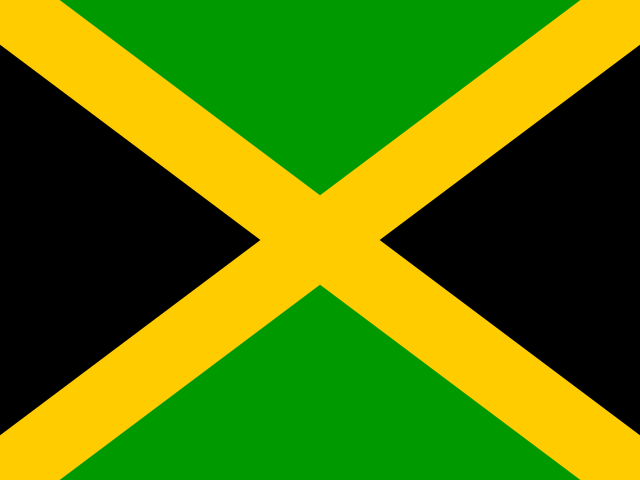
A diagonal yellow cross divides Jamaica's flag into four triangles: green at the top and bottom, and black at the left and right. Green stands for hope, vegetation, and agriculture; black stands for hardships overcome and to be faced, while yellow stands for sunshine and natural resources. The national symbols are the green-and-black streamertail (bird) and guaiacwood ( Guiacum officinale ).
Source: CIA World Factbook · 2026-02-01 · text generated from this source, approved by a person
CIA World Factbook
Values from the CIA World Factbook archive. Each carries the year it describes; open a year for the exact source field.
Natural Earth outlines · features with a Wikidata ID
Population · Natural Earth