Overview
Geography
An island between the Caribbean Sea and Atlantic Ocean, Grenada lies north of Trinidad and Tobago. Its volcanic terrain includes central mountains.
Timber and tropical fruit are among Grenada's natural resources. Mount Saint Catherine is the country's highest point. The Caribbean Sea is the country's lowest point.
Source: CIA World Factbook · 2026-02-01 · text generated from this source, approved by a person
Climate
Northeast trade winds temper Grenada's tropical climate. The island lies on the edge of the hurricane belt, with a hurricane season from June to November.
Source: CIA World Factbook · 2026-02-01 · text generated from this source, approved by a person
Government
A parliamentary democracy under a constitutional monarchy, Grenada is also a Commonwealth realm. Its legal system is common law based on the English model. The latest constitution was presented 19 December 1973 and took effect 7 February 1974; it was suspended 1979 following a revolution but restored in 1983. Grenada gained independence from the UK on 7 February 1974, observed as Independence Day.
Source: CIA World Factbook · 2026-02-01 · text generated from this source, approved by a person
Flag and symbols
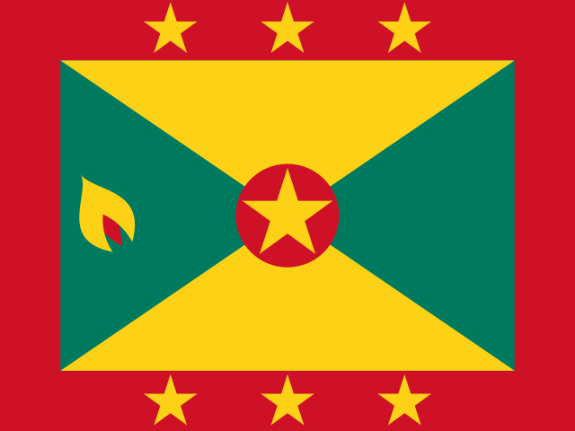
A red border surrounds yellow top and bottom triangles and green left and right triangles; yellow stars line the border, a larger star centers a red disk, and a small yellow-and-red nutmeg pod sits on the left triangle. Stars symbolize administrative divisions; the central star symbolizes St. George's, the capital, while yellow stands for the sun, green vegetation, and red harmony. National symbols include the Grenada dove and bougainvillea flower.
Source: CIA World Factbook · 2026-02-01 · text generated from this source, approved by a person
Natural geography 1
Natural Earth outlines · features with a Wikidata ID
 Grenada