Name
The archipelago's name derives from the Old Norse "Faeroyar," meaning "sheep islands"; "faer" means "sheep," and "- oyar" means "islands".
Source: CIA World Factbook · 2026-02-01 · text generated from this source, approved by a person
 Faroe Islands
62.19° N, 7.06° W
No land border at all — every neighbor is across water, along 1,117 km of coast, the 80th longest on Earth.
land borders 0 km · 164th/230 · coastline 1,117 km · 80th/229
CIA World Factbook · 2026-02-01 · ranks computed across the countries in this atlas that carry the value
geometry: Natural Earth 1:50m · EPSG:6933 equal-area
Each line is every country in this atlas that carries the value, ordered smallest to largest. The line down the middle is the world median; the mark on each line is this country.
The archipelago's name derives from the Old Norse "Faeroyar," meaning "sheep islands"; "faer" means "sheep," and "- oyar" means "islands".
Source: CIA World Factbook · 2026-02-01 · text generated from this source, approved by a person
Populated by about 500 CE, the islands had original settlers whose identity—Celtic, early Norse, or someone else—has yet to be determined. Viking settlers arrived in the 9th century, and the islands served as an important stepping stone for medieval Viking exploration of the North Atlantic. Political ties have connected the islands to Denmark since the 14th century, and they are now a self-governing dependency of Denmark.
The Home Rule Act of 1948 granted the Faroese a high degree of self-government, giving them autonomy over most internal affairs and external trade while Denmark is responsible for justice, defense, and some foreign affairs. The Faroe Islands are not part of the European Union.
Source: CIA World Factbook · 2026-02-01 · text generated from this source, approved by a person
Mild winters and cool summers meet usually overcast skies, fog, and wind. Strong winds and heavy rains can occur throughout the year.
Source: CIA World Factbook · 2026-02-01 · text generated from this source, approved by a person
A parliamentary democracy through the Faroese Parliament, the Faroe Islands is part of the Kingdom of Denmark. The laws of Denmark apply in the Faroe Islands. The Danish Constitution of 5 June 1953, the Home Rule Act of 23 March 1948, and the Takeover Act of 24 June 2005 serve as the Faroe Islands' constitutional position in the Unity of the Realm. The Faroe Islands has no independence and is a self-governing overseas administrative division of Denmark. Its national holiday is Olaifest (Olavsoka), on 29 July (1030).
Source: CIA World Factbook · 2026-02-01 · text generated from this source, approved by a person
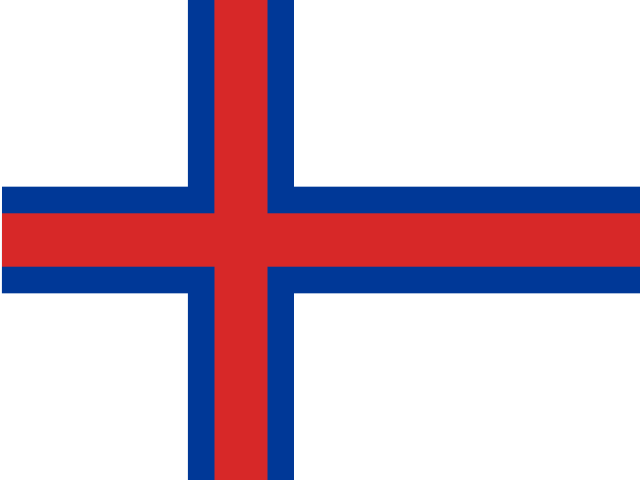
A white flag carries a red cross outlined in blue, extending to its edges and shifted toward the left in the style of the Dannebrog, the Danish flag. White represents waves breaking on the shore, while red and blue are traditional Faroese colors. The flag is called Merkid, meaning 'the banner' or 'the mark'; a group of students designed it in 1919, although it was officially adopted in 1940.
Source: CIA World Factbook · 2026-02-01 · text generated from this source, approved by a person
CIA World Factbook
Values from the CIA World Factbook archive. Each carries the year it describes; open a year for the exact source field.
Natural Earth outlines · features with a Wikidata ID