Name
Spanish explorers named Cayman Islands in the early 16th century, using the Carib word for marine crocodiles, "caiman".
Source: CIA World Factbook · 2026-02-01 · text generated from this source, approved by a person
 Cayman Islands
19.32° N, 81.24° W
100% of everyone here lives in a city.
urban population 100% · 1st/225
CIA World Factbook · 2026-02-01 · ranks computed across the countries in this atlas that carry the value
geometry: Natural Earth 1:50m · EPSG:6933 equal-area
Each line is every country in this atlas that carries the value, ordered smallest to largest. The line down the middle is the world median; the mark on each line is this country.
Spanish explorers named Cayman Islands in the early 16th century, using the Carib word for marine crocodiles, "caiman".
Source: CIA World Factbook · 2026-02-01 · text generated from this source, approved by a person
The British colonized the Cayman Islands during the 18th and 19th centuries. After 1863, Jamaica, also a British colony at the time, administered the islands.
In 1959, the Cayman Islands became a territory within the Federation of the West Indies. When the Federation dissolved in 1962, the Cayman Islands chose to remain a British dependency. The territory has transformed itself into a significant offshore financial center.
Source: CIA World Factbook · 2026-02-01 · text generated from this source, approved by a person
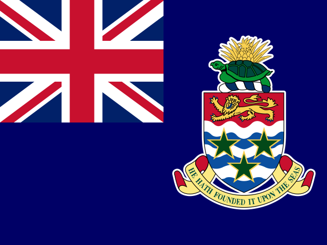
A blue field bears the UK flag in the upper-left quadrant and Caymanian arms centered on the right. The arms show pineapple, turtle, shield with a golden lion and three green stars, and a scroll bearing "HE HATH FOUNDED IT UPON THE SEAS". Pineapple, turtle, lion, stars, and white-and-blue wavy lines represent ties to Jamaica, the Caymans’ seafaring tradition, Great Britain, three islands, and the sea. The national symbol is the green sea turtle.
Source: CIA World Factbook · 2026-02-01 · text generated from this source, approved by a person
CIA World Factbook
Values from the CIA World Factbook archive. Each carries the year it describes; open a year for the exact source field.
Natural Earth outlines · features with a Wikidata ID