Overview
Name
The name partly derives from the Indonesian and Malay word "timur," meaning "east," and from the Portuguese word "leste," also meaning "east." Together, "Timor-Leste" literally means "Eastern-East."
Source: CIA World Factbook · 2026-02-01 · text generated from this source, approved by a person
Background
Timor joined Southeast Asian trading networks for centuries, exporting sandalwood, slaves, honey, and wax by the 14th century. Portugal arrived for sandalwood in the early 16th century and colonized the island by mid-century, after local chieftains ruled. Portugal ceded western Timor to the Dutch in 1859; Japan occupied Portuguese Timor from 1942 to 1945, after which Portugal resumed colonial authority. On 28 November 1975, the eastern part declared independence from Portugal; Indonesian forces invaded nine days later. Indonesia incorporated it in 1976 as Timor Timur and conducted an unsuccessful pacification campaign for two decades.
In a UN-supervised 1999 referendum, an overwhelming majority voted for independence from Indonesia, but anti-independence militias began a campaign of retribution. Most infrastructure was destroyed before Australian-led peacekeepers ended the violence. Timor-Leste was internationally recognized as an independent state in 2002. Australia and the UN intervened again in 2006, enabling 2007 presidential and parliamentary elections; rebels unsuccessfully attacked the president and prime minister in 2008. Since 2012, Timor-Leste has held successful parliamentary and presidential elections. Weak, unstable coalitions have led to periodic stalemate and crisis, while UN assistance continues on economic development and governing institutions. Timor-Leste's economy relies heavily on energy resources in the Timor Sea.
Source: CIA World Factbook · 2026-02-01 · text generated from this source, approved by a person
Geography
Located completely in the Southern Hemisphere, Timor-Leste is the only Asian country there. At the eastern end of the Indonesian archipelago, it occupies the eastern portion of Timor and includes the Oecussi region, Pulau Atauro, and Pulau Jaco. Northwest of Australia, Timor-Leste lies in the Lesser Sunda Islands.
Oecussi is an exclave separated from Timor-Leste proper by Indonesia. Timor-Leste has mountainous terrain. Its natural resources include gold, petroleum, natural gas, manganese, and marble. Foho Tatamailau is the country's highest point. The Timor Sea, Savu Sea, and Banda Sea mark its lowest point.
Source: CIA World Factbook · 2026-02-01 · text generated from this source, approved by a person
Government
A semi-presidential republic uses a civil law system based on the Portuguese model. The constitution was drafted 2001, approved 22 March 2002, and entered into force 20 May 2002. Independence dates are 28 November 1975 from Portugal and 20 May 2002 from Indonesia. Its national holidays are Restoration of Independence Day, 20 May (2002), and Proclamation of Independence Day, 28 November (1975).
Source: CIA World Factbook · 2026-02-01 · text generated from this source, approved by a person
Flag and symbols
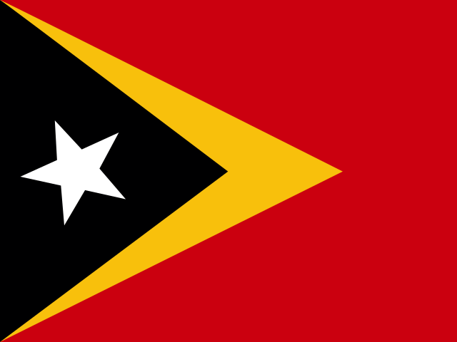
Red forms the flag's field, with a black isosceles triangle based on the left side on a slightly longer yellow arrowhead extending to the center. A white star is in the center of the black triangle and represents peace and a guiding light. Yellow stands for past colonialism, black for obscurantism that needs to be overcome, and red for the struggle for freedom. The national symbol is Mount Ramelau.
Source: CIA World Factbook · 2026-02-01 · text generated from this source, approved by a person
 Timor-Leste