Climate
A temperate climate brings heavier rainfall in summer than in winter and cold winters. Occasional typhoons bring high winds and floods.
Source: CIA World Factbook · 2026-02-01 · text generated from this source, approved by a person
 South Korea
36.38° N, 128.13° E
2,413 km of coast against 237 km of land border — this country faces the sea far more than it faces its neighbors.
coastline 2,413 km · 53rd/229 · land borders 237 km · 150th/230
CIA World Factbook · 2026-02-01 · ranks computed across the countries in this atlas that carry the value
geometry: Natural Earth 1:50m · EPSG:6933 equal-area
Each line is every country in this atlas that carries the value, ordered smallest to largest. The line down the middle is the world median; the mark on each line is this country.
A temperate climate brings heavier rainfall in summer than in winter and cold winters. Occasional typhoons bring high winds and floods.
Source: CIA World Factbook · 2026-02-01 · text generated from this source, approved by a person
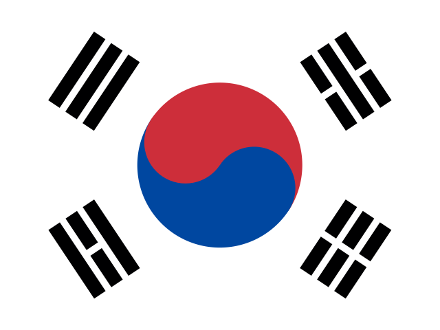
Taegukki, the white flag, carries a red-and-blue yin-yang symbol and black trigrams (kwae) in each corner. White represents peace and purity; blue stands for the negative cosmic forces of the yin, and red for the opposite positive forces of the yang. Each trigram represents a universal element; together they express the principle of movement and harmony. National symbols are taegeuk (yin-yang symbol), Rose of Sharon (Hibiscus syriacus), and Siberian tiger.
Source: CIA World Factbook · 2026-02-01 · text generated from this source, approved by a person
CIA World Factbook
Values from the CIA World Factbook archive. Each carries the year it describes; open a year for the exact source field.
Natural Earth outlines · features with a Wikidata ID
Population · Natural Earth