Name
The name comes from English midshipman Robert Pitcairn, who first sighted the island in 1767.
Source: CIA World Factbook · 2026-02-01 · text generated from this source, approved by a person
 Pitcairn Islands
24.36° S, 128.32° W
No land border at all — every neighbor is across water, along 51 km of coast, the 173rd longest on Earth.
land borders 0 km · 164th/230 · coastline 51 km · 173rd/229
CIA World Factbook · 2026-02-01 · ranks computed across the countries in this atlas that carry the value
geometry: Natural Earth 1:50m · EPSG:6933 equal-area
Each line is every country in this atlas that carries the value, ordered smallest to largest. The line down the middle is the world median; the mark on each line is this country.
The name comes from English midshipman Robert Pitcairn, who first sighted the island in 1767.
Source: CIA World Factbook · 2026-02-01 · text generated from this source, approved by a person
Britain's most isolated dependency lies in Oceania, in the South Pacific Ocean, about midway between Peru and New Zealand. The terrain is a rugged volcanic formation, with a rocky coastline and cliffs. Only Pitcairn, the larger island, is inhabited, but it has no port or natural harbor.
Supplies reach the island by longboat from larger ships stationed offshore. Miro trees, used for handicrafts, and fish are listed as natural resources. Palwala Valley Point on Big Ridge is the highest point, while the Pacific Ocean forms the lowest point.
Source: CIA World Factbook · 2026-02-01 · text generated from this source, approved by a person
Southeast trade winds modify the Pitcairn Islands’ tropical climate, which is hot and humid. A rainy season occurs, while occasional tropical cyclones are generally only heavy tropical storms.
Source: CIA World Factbook · 2026-02-01 · text generated from this source, approved by a person
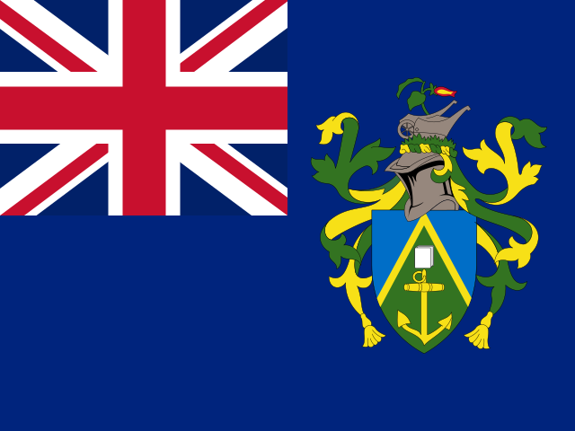
A blue field carries the UK flag in its upper-left quadrant and the Pitcairn Islander coat of arms centered on its right half. Its green field features a yellow anchor with a Bible over it, both of which were on the HMS Bounty. The crest shows a Pitcairn Island wheelbarrow and a flowering twig of miro, a local plant; the green, yellow, and blue of the shield represent the island rising from the ocean.
Source: CIA World Factbook · 2026-02-01 · text generated from this source, approved by a person
CIA World Factbook
Values from the CIA World Factbook archive. Each carries the year it describes; open a year for the exact source field.
Natural Earth outlines · features with a Wikidata ID