Overview
Name
Its name derives from the Malay word "pua-pua," describing the tightly curled hair of the Papuan people. In 1545, Spanish explorer Ynigo Ortiz de Retez applied "Nueva Guinea" to the island because he thought its locals resembled the peoples of the Guinea coast of Africa.
Source: CIA World Factbook · 2026-02-01 · text generated from this source, approved by a person
Background
Mountains, jungles, and river valleys isolated arriving groups, giving rise to PNG’s ethnic and linguistic diversity. Around 500 BCE, Austronesian voyagers settled along the coast. Spanish and Portuguese explorers periodically visited the island starting in the 1500s, but none reached the interior. In 1884, Germany declared a protectorate over the northern part of what would become PNG and named it German New Guinea; days later, the UK followed in the southern part and nearby islands. Germany named its territory German New Guinea, while the UK called its territory Papua.
The UK put Papua under Australian administration in 1902 and formalized the arrangement in 1906. After World War I, Australia continued ruling German New Guinea as a League of Nations Mandate, then combined the territories after the war and administered PNG as a UN trusteeship. In 1975, PNG gained independence and became a member of the Commonwealth. In 1997, the PNG Government and Bougainville leaders reached a cease-fire and signed a peace agreement in 2001. The Autonomous Bougainville Government was formally established in 2005. Bougainvilleans voted in favor of independence in a 2019 non-binding referendum. The Bougainville and PNG governments are negotiating a roadmap for independence, which requires approval by the PNG parliament.
Source: CIA World Factbook · 2026-02-01 · text generated from this source, approved by a person
Geography
An island group in Oceania includes the eastern half of New Guinea, between the Coral Sea and the South Pacific Ocean, east of Indonesia. Papua New Guinea shares New Guinea with Indonesia. East-to-west highlands break up New Guinea into diverse ecoregions. The terrain is mostly mountains, with coastal lowlands and rolling foothills.
Along the southwest coast lies one of the world's largest swamps. Papua New Guinea is among the countries along the Ring of Fire, a belt bordering the Pacific Ocean that contains volcanoes and earthquakes. Its natural resources include gold, copper, silver, natural gas, timber, oil, and fisheries. Mount Wilhelm is the highest point. The Pacific Ocean is the lowest point.
Source: CIA World Factbook · 2026-02-01 · text generated from this source, approved by a person
Government
Under a constitutional monarchy, Papua New Guinea has a parliamentary democracy and is a Commonwealth realm. Its legal system combines English common law and customary law. The constitution was adopted 15 August 1975 and became effective at independence on 16 September 1975. Independence came 16 September 1975 from the Australia-administered UN trusteeship. Independence Day, 16 September (1975), is the national holiday.
Source: CIA World Factbook · 2026-02-01 · text generated from this source, approved by a person
Flag and symbols
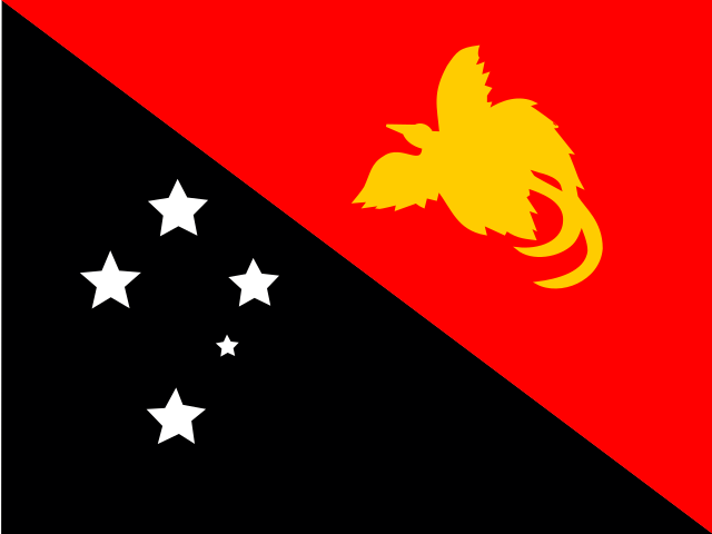
Diagonally divided from the upper-left corner, the flag has a red upper triangle with a soaring yellow bird of paradise at its center and a black lower triangle with five five-pointed white stars of the Southern Cross constellation. The bird of paradise is the national symbol. The Southern Cross symbolizes the country's connection with Australia and several other countries in the South Pacific.
Source: CIA World Factbook · 2026-02-01 · text generated from this source, approved by a person
 Papua New Guinea