Overview
Background
Humans arrived in the Palauan archipelago from Southeast Asia around 1000 BCE, developing a complex, highly organized matrilineal society whose high-ranking women picked the chiefs. The islands were the westernmost part of the Pacific islands north of New Guinea, named the Caroline Islands by Spanish explorers in the 17th century; whalers and traders visited occasionally in the 18th and 19th centuries. Spain sold Palau to Germany in 1899 after losing the Philippines in the Spanish-American War. Japan seized Palau in 1914, received a League of Nations mandate in 1920, and made Koror its capital in 1922. After World War II, Palau became part of the US-administered Trust Territory of the Pacific Islands.
Palau voted against joining the Federated States of Micronesia in 1978, adopted a nuclear-free constitution in 1981, and signed a Compact of Free Association with the US in 1982. The agreement granted Palau financial assistance and access to many US domestic programs in exchange for exclusive US military access and defense responsibilities. The agreement was ratified and entered into force in 1994, when Palau gained independence. In 2011, Palau banned commercial shark fishing and created a shark sanctuary. In 2020, it banned coral reef-toxic sunscreens.
Source: CIA World Factbook · 2026-02-01 · text generated from this source, approved by a person
Geography
An archipelago in Oceania and the North Pacific Ocean, Palau lies southeast of the Philippines. It forms the westernmost archipelago in the Caroline chain. Its terrain ranges from the high, mountainous main island of Babelthuap to low coral islands usually fringed by large barrier reefs.
Palau's natural resources include forests, minerals—especially gold—marine products, and deep-seabed minerals. Mount Ngerchelchuus is Palau's highest point. The Pacific Ocean is Palau's lowest point.
Source: CIA World Factbook · 2026-02-01 · text generated from this source, approved by a person
People and society
Most of Palau's population lives at the southern end of Babelthuap, the main island. Palau's ethnic groups include Palauan people, described as Micronesian with Malayan and Melanesian admixtures, Carolinian people, and Asian people.
Roman Catholic and Protestant affiliations are present, with Protestant groups including Evangelical, Seventh Day Adventist, and other Protestant communities. Modekngei, indigenous to Palau, and Muslim affiliations are also present, along with other religions.
Source: CIA World Factbook · 2026-02-01 · text generated from this source, approved by a person
Flag and symbols
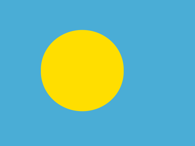
A light-blue flag carries a large yellow disk on its left side. The blue stands for the ocean, while the disk stands for the moon, considered a symbol of peace, love, and tranquility. The national symbol is the bai, a native meeting house.
Source: CIA World Factbook · 2026-02-01 · text generated from this source, approved by a person
 Palau
Palau