Name
In 1774, British explorer Captain James Cook named Norfolk Island after Edward Howard, the ninth Duke of Norfolk.
Source: CIA World Factbook · 2026-02-01 · text generated from this source, approved by a person
 Norfolk Island
29.03° S, 167.95° E
No land border at all — every neighbor is across water, along 32 km of coast, the 179th longest on Earth.
land borders 0 km · 164th/230 · coastline 32 km · 179th/229
CIA World Factbook · 2026-02-01 · ranks computed across the countries in this atlas that carry the value
geometry: Natural Earth 1:50m · EPSG:6933 equal-area
Each line is every country in this atlas that carries the value, ordered smallest to largest. The line down the middle is the world median; the mark on each line is this country.
In 1774, British explorer Captain James Cook named Norfolk Island after Edward Howard, the ninth Duke of Norfolk.
Source: CIA World Factbook · 2026-02-01 · text generated from this source, approved by a person
A subtropical climate brings mild conditions with little seasonal temperature variation. Tropical cyclones occur especially from May to July.
Source: CIA World Factbook · 2026-02-01 · text generated from this source, approved by a person
The population includes Australian, English, Pitcairn Islander, Scottish, and Irish people. The population is concentrated around the capital of Kingston.
Protestant affiliations include Anglican, Uniting Church in Australia, Presbyterian, Seventh Day Adventist, and other Protestant affiliations. Roman Catholic, other Christian, other, no religion, and unspecified affiliations also appear among the religious affiliations.
Source: CIA World Factbook · 2026-02-01 · text generated from this source, approved by a person
Administered as an overseas territory of Australia, Norfolk Island has no independence and is a territory of Australia. Its legal system consists of English common law and the laws of Australia. The latest constitution took effect 7 August 1979. Bounty Day, the national holiday, commemorates the arrival of Pitcairn Islanders on 8 June (1856).
Source: CIA World Factbook · 2026-02-01 · text generated from this source, approved by a person
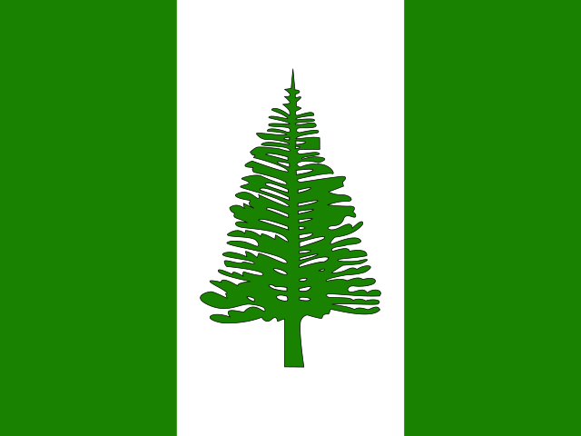
The flag has three vertical bands of green on the left, white, and green, with a large green Norfolk Island pine tree centered on the white band. Green stands for the island's rich vegetation, while the native pine tree is an island symbol. The Norfolk Island pine is the national symbol.
Source: CIA World Factbook · 2026-02-01 · text generated from this source, approved by a person
CIA World Factbook
Values from the CIA World Factbook archive. Each carries the year it describes; open a year for the exact source field.
Natural Earth outlines · features with a Wikidata ID