Overview
Name
In Niuean, the name translates as "behold the coconut," though its origin is obscure. The former name, Savage Island, resulted from an acrimonious meeting in 1774 between English explorer Captain James Cook and local people.
Source: CIA World Factbook · 2026-02-01 · text generated from this source, approved by a person
Geography
Niue lies in the South Pacific Ocean, east of Tonga. Its coast has steep limestone cliffs, while a central plateau occupies the island's interior.
Niue is among the world's largest coral islands; its surrounding coral reef has its only major break in the central western part of the coast. Its natural resources include arable land and fish. The highest point is an unnamed elevation east of Hikutavake. The Pacific Ocean forms the lowest point.
Source: CIA World Factbook · 2026-02-01 · text generated from this source, approved by a person
Climate
Tropical conditions are modified by southeast trade winds. Tropical cyclones are a natural hazard.
Source: CIA World Factbook · 2026-02-01 · text generated from this source, approved by a person
People and society
Niuean, part-Niuean, and non-Niuean people make up the population. The population is distributed around the peripheral coastal areas of the island.
Religious affiliations include Ekalesia Niue, Latter Day Saints, Roman Catholic, Jehovah's Witnesses, and Seventh Day Adventist.
Source: CIA World Factbook · 2026-02-01 · text generated from this source, approved by a person
Government
A parliamentary democracy governs Niue. English common law forms its legal system. The current constitution is the Niue Constitution Act 1974, dated 19 October 1974. On 19 October 1974, Niue became a self-governing state in free association with New Zealand. Waitangi Day, on 6 February (1840), marks the Treaty of Waitangi, which established British sovereignty over New Zealand.
Source: CIA World Factbook · 2026-02-01 · text generated from this source, approved by a person
Flag and symbols
The flag is yellow, with the UK flag in its upper-left quadrant. The UK flag has five yellow five-pointed stars: a large star on a blue central disk and smaller stars on each arm of the red cross. The large star represents Niue; smaller stars symbolize links with New Zealand. Yellow stands for sunshine, warmth, and friendship between Niue and New Zealand. A yellow five-pointed star is the national symbol.
Source: CIA World Factbook · 2026-02-01 · text generated from this source, approved by a person
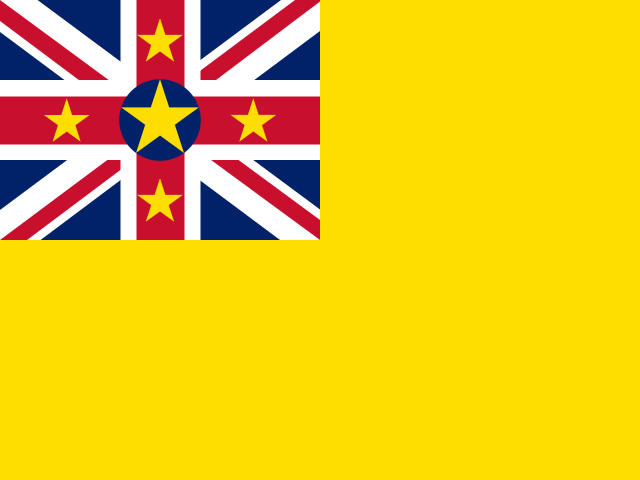 Niue
Niue