Overview
Background
Nomadic empires shaped Mongolia from the Xiongnu in the 4th century BCE; Mongol goes back to at least the 11th century CE. Temüüjin became ruler of all Mongols in the early 1200s and created an empire across much of Eurasia by his death in 1227. Ögödei and Khubilai conquered Eastern Europe, the Middle East, and China; Khubilai established the Yuan Dynasty in the 1270s. Mongolia fell under Manchu rule in the 17th century, declared independence in 1911, and won it in 1921 with Soviet help. It became a socialist state in 1924 and a Soviet satellite until 1989, amid repression and tensions with China.
Mongolia transitioned peacefully to democracy in 1990, adopting a constitution and free-market economy in 1992. The Mongolian People's Revolutionary Party became the Mongolian People’s Party (MPP) in 2010 and competed with the Democratic Party. For most of its democratic history, government was divided; the MPP secured a parliamentary supermajority in 2020 and won the presidency in 2021. Ukhnaagiin Khurelsukh won the June 2021 presidential election; Mongolia maintains close ties with Russia, while China is its largest economic partner.
Source: CIA World Factbook · 2026-02-01 · text generated from this source, approved by a person
Geography
Mongolia lies in Northern Asia between China and Russia. It is landlocked and has a strategic location between China and Russia. Across its territory, vast semidesert and desert plains meet grassy steppe, while mountains rise in the west and southwest. The Gobi Desert lies in the south-central part of the country.
Mongolia's natural resources include oil, coal, copper, molybdenum, tungsten, phosphates, tin, nickel, zinc, fluorspar, gold, silver, and iron. Nayramadlin Orgil (Khuiten Peak) is the country's highest point. Hoh Nuur is the country's lowest point.
Source: CIA World Factbook · 2026-02-01 · text generated from this source, approved by a person
Climate
Desert conditions combine with a continental climate, bringing large temperature ranges from day to night and across seasons. Climate hazards include dust storms, drought, and “zud,” a term for harsh winter conditions.
Source: CIA World Factbook · 2026-02-01 · text generated from this source, approved by a person
People and society
Khalkh, Kazak, Durvud, Bayad, Buriad, Zakhchin, Dariganga, and others make up Mongolia's ethnic groups. Mongolian is the official language; its Khalkha dialect is predominant, alongside Turkic and Russian.
Religious affiliations include Buddhist, no religion, Muslim, Shaman, Christian, and other beliefs. Population is sparsely distributed throughout the country, while the capital, Ulaanbaatar, and the northern city of Darhan support the highest population densities.
Source: CIA World Factbook · 2026-02-01 · text generated from this source, approved by a person
Flag and symbols
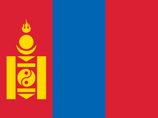
The flag's three equal vertical bands are red, blue, and red from left to right, with the yellow soyombo centered on the left red band. The soyombo abstractly represents fire, sun, moon, earth, water, and the yin-yang symbol; blue stands for the sky, while red stands for progress and prosperity. The national symbol is the Soyombo character from the Soyombo writing system.
Source: CIA World Factbook · 2026-02-01 · text generated from this source, approved by a person
 Mongolia