Name
The name Mauritius comes from Prince Maurice Van Nassau, "stadtholder" (governor) of the Dutch Republic, after whom it was named in 1598.
Source: CIA World Factbook · 2026-02-01 · text generated from this source, approved by a person
 Mauritius
20.30° S, 57.57° E
No land border at all — every neighbor is across water, along 177 km of coast, the 141st longest on Earth.
land borders 0 km · 164th/230 · coastline 177 km · 141st/229
CIA World Factbook · 2026-02-01 · ranks computed across the countries in this atlas that carry the value
geometry: Natural Earth 1:50m · EPSG:6933 equal-area
Each line is every country in this atlas that carries the value, ordered smallest to largest. The line down the middle is the world median; the mark on each line is this country.
The name Mauritius comes from Prince Maurice Van Nassau, "stadtholder" (governor) of the Dutch Republic, after whom it was named in 1598.
Source: CIA World Factbook · 2026-02-01 · text generated from this source, approved by a person
Known to Arab and European sailors since at least the early 1500s, Mauritius was uninhabited until 1638, when Dutch settlers honored Prince Maurits van NASSAU. In 1722, the French established a highly profitable sugar-cane settlement using enslaved labor from other parts of Africa. Plantation owners briefly rejected French control in the 1790s over laws ending slavery, creating autonomous rule.
Britain captured Mauritius in 1810 during the Napoleonic Wars but kept most French administration, reflected in legal codes and widespread French Creole. Slavery ended in 1835, increasing reliance on contracted laborers from the Indian subcontinent for plantations. Mauritius served as a naval base and later air station, supporting World War II anti-submarine, convoy, and signals-intelligence operations. After independence from the UK in 1968 as a Parliamentary Republic, it remained a stable democracy with free elections. Pravind Jugnauth became prime minister in 2017 after his father stepped down and won election in his own right in 2019. Mauritius claims the French island of Tromelin and the British Chagos Archipelago. Since 2017, Mauritius has secured favorable UN General Assembly resolutions and an International Court of Justice advisory opinion in its sovereignty dispute with the UK.
Source: CIA World Factbook · 2026-02-01 · text generated from this source, approved by a person
An island in the Indian Ocean, Mauritius is in Southern Africa, east of Madagascar. The main island, from which the country derives its name, is of volcanic origin and is almost entirely surrounded by coral reefs. It was the former home of the extinct dodo, a large flightless bird related to pigeons.
Its small coastal plain rises to discontinuous mountains encircling a central plateau. The country's natural resources include arable land and fish. Mont Piton is the highest point. The Indian Ocean is the lowest point.
Source: CIA World Factbook · 2026-02-01 · text generated from this source, approved by a person
Mauritius's ethnic groups include Indo-Mauritian, Creole, Sino-Mauritian, and Franco-Mauritian people. Hindu, Roman Catholic, Muslim, other Christian, and other religious affiliations are represented in Mauritius, alongside people with no religion or an unspecified affiliation.
Mauritius has a population density among the world's highest, with urban clusters throughout the main island. These clusters are denser in and around Port Luis, while Rodrigues Island's population is fairly evenly spread, with a slightly denser cluster on its north coast.
Source: CIA World Factbook · 2026-02-01 · text generated from this source, approved by a person
A parliamentary republic governs Mauritius. Its legal system is a civil system based on French civil law, with some elements of English common law. The latest constitution was adopted 12 March 1968, after several previous constitutions. Mauritius gained independence from the UK on 12 March 1968. Its national holiday is Independence and Republic Day, 12 March (1968, 1992).
Source: CIA World Factbook · 2026-02-01 · text generated from this source, approved by a person
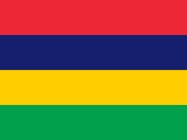
Four equal horizontal bands—red at the top, followed by blue, yellow, and green—form the flag of Mauritius. Red stands for self-determination and independence; blue for the Indian Ocean; yellow for the new light of independence, golden sunshine, or the bright future; and green for agriculture or the island's lush vegetation. Mauritius's national symbols are the dodo bird and the earring tree flower (Trochetia boutoniana).
Source: CIA World Factbook · 2026-02-01 · text generated from this source, approved by a person
CIA World Factbook
Values from the CIA World Factbook archive. Each carries the year it describes; open a year for the exact source field.
Natural Earth outlines · features with a Wikidata ID
Population · Natural Earth