Name
Indonesia's name is an 18th-century construct of two Greek words, "Indos" (India) and "nesoi" (islands), meaning "Indian islands".
Source: CIA World Factbook · 2026-02-01 · text generated from this source, approved by a person
 Indonesia
0.95° S, 101.89° E
270,625,568 people live here — the 4th largest population on Earth.
population 270,625,568 · 4th/235
Natural Earth · ranks computed across the countries in this atlas that carry the value
geometry: Natural Earth 1:50m · EPSG:6933 equal-area
Each line is every country in this atlas that carries the value, ordered smallest to largest. The line down the middle is the world median; the mark on each line is this country.
Indonesia's name is an 18th-century construct of two Greek words, "Indos" (India) and "nesoi" (islands), meaning "Indian islands".
Source: CIA World Factbook · 2026-02-01 · text generated from this source, approved by a person
An archipelago in Southeastern Asia lies between the Indian Ocean and the Pacific Ocean. Its terrain consists mostly of coastal lowlands, while larger islands contain interior mountains.
Indonesia's natural resources include petroleum, tin, natural gas, nickel, timber, bauxite, copper, fertile soils, coal, gold, and silver. Puncak Jaya is the highest point. The Indian/Pacific Oceans form the lowest point.
Source: CIA World Factbook · 2026-02-01 · text generated from this source, approved by a person
Hot, humid conditions define Indonesia's tropical climate, while the highlands are more moderate.
Source: CIA World Factbook · 2026-02-01 · text generated from this source, approved by a person
A presidential republic, Indonesia uses a civil law system based on the Roman-Dutch model and influenced by customary law. The constitution was drafted July to August 1945, took effect 18 August 1945, was abrogated by the 1949 and 1950 constitutions, and was restored 5 July 1959. Indonesia declared independence from the Netherlands on 17 August 1945, while its national holiday is Independence Day, 17 August (1945).
Source: CIA World Factbook · 2026-02-01 · text generated from this source, approved by a person
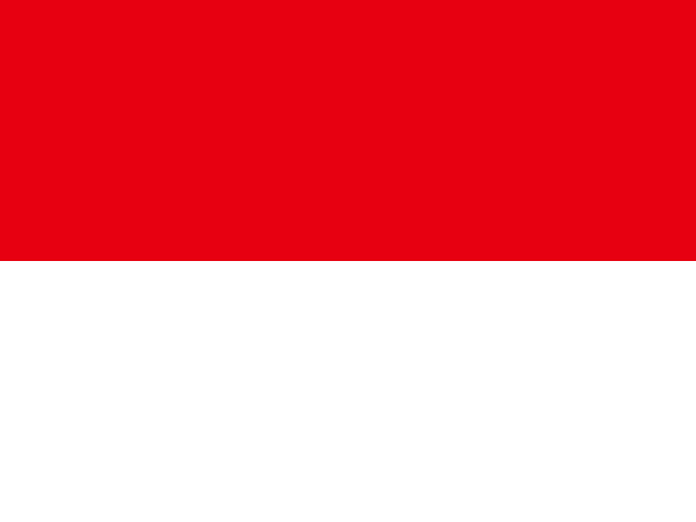
The flag has two equal horizontal bands, red above white; red stands for courage and white for purity. Its colors derive from the banner of the Majapahit Empire. The national symbol is garuda, a mythical bird.
Source: CIA World Factbook · 2026-02-01 · text generated from this source, approved by a person
CIA World Factbook
Values from the CIA World Factbook archive. Each carries the year it describes; open a year for the exact source field.
Natural Earth outlines · features with a Wikidata ID
Population · Natural Earth