14 cities

Location of GhanaEquatorial GuineaSierra LeoneGabonTogoBurkina FasoMaliSenegalBeninNigeriaLiberiaGambiaGuinea-BissauCameroonCôte d'IvoireNigerSão Tomé and PrincipeGuineaMauritaniaGhanaBolgatangaAccraSekondiObuasiHoKoforiduaKumasiTamaleTemaCape Coast
Country

Ghana

7.72° N, 1.04° W

2,420 km of land border against just 539 km of coast — this country faces its neighbors far more than it faces the sea.

coastline 539 km · 100th/229 · land borders 2,420 km · 79th/230
CIA World Factbook · 2026-02-01 · ranks computed across the countries in this atlas that carry the value

Population
30,417,856
Area
238,533 km²
Population density
≈ 128 / km²
Capital
Accra
Natural Earth
ISO codes
GH · GHA
GDP (nominal)
$82.83 billion
GDP per capita (PPP)
$7,100
How big, reallyDrawn at the same scale as Senegal — the next country down in size. Equal-area projection, not the map you are used to.
Ghana 238,533 km²Senegal 196,722 km²

geometry: Natural Earth 1:50m · EPSG:6933 equal-area

Where Ghana sits in the world

Each line is every country in this atlas that carries the value, ordered smallest to largest. The line down the middle is the world median; the mark on each line is this country.

  1. Median age21.6 years187th of 224 · median 32.6 years
  2. Life expectancy70.1 years176th of 224 · median 76.2 years
  3. Fertility rate3.51 children per woman35th of 225 · median 1.92 children per woman
  4. Population30,417,85646th of 235 · median 5,454,073
  5. Total area238,533 km²82nd of 228 · median 83,736 km²
  6. Coastline539 km100th of 229 · median 402 km

Overview

Name

Ghana was named for a tribal chieftain who ruled the region before the 13th century, though his territory lay northwest of modern-day Ghana. The former name, Gold Coast, came from gold Portuguese explorers discovered there in the late 15th century.

Source: CIA World Factbook · 2026-02-01 · text generated from this source, approved by a person

Geography

Lake Volta is the world's largest artificial lake by surface area and a manmade reservoir. The lake was created after the Akosombo Dam was completed. Ghana lies in Western Africa, bordering the Gulf of Guinea between Côte d'Ivoire and Togo. Ghana's terrain consists mostly of low plains, with a dissected plateau in the south-central area.

Ghana's natural resources include gold, timber, industrial diamonds, bauxite, manganese, fish, rubber, hydropower, petroleum, silver, salt, and limestone. Ghana's highest point is Mount Afadjato. Ghana's lowest point is the Atlantic Ocean.

Source: CIA World Factbook · 2026-02-01 · text generated from this source, approved by a person

Climate

Tropical conditions vary across Ghana: the southeast coast is warm and comparatively dry, the southwest hot and humid, and the north hot and dry. Dry, dusty northeastern harmattan winds and droughts are natural hazards.

Source: CIA World Factbook · 2026-02-01 · text generated from this source, approved by a person

People and society

Akan, Mole-Dagbani, Ewe, Ga-Dangme, Gurma, Guan, Grusi and Mande form the country's named ethnic groups, alongside other groups.

Christians include Pentecostal/Charismatic, Protestant, Catholic and other communities; Muslims, traditionalists, people of other faiths and people with no religion are also present. People are concentrated in the southern half of the country, with the highest concentrations on or near the Atlantic coast.

Source: CIA World Factbook · 2026-02-01 · text generated from this source, approved by a person
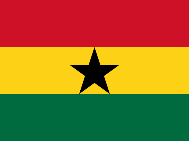
Key figures

CIA World Factbook

Economy

GDP (nominal)
$82.83 billion
GDP (PPP)
$243.12 billion
GDP per capita (PPP)
$7,100
GDP growth
+5.7%
Inflation (consumer prices)
22.8%
Unemployment
3.1%
Exports
$25.37 billion
Imports
$26.02 billion

People

Life expectancy
70.1 years
Median age
21.6 years
Birth rate
27.09 per 1,000
Death rate
5.73 per 1,000
Fertility rate
3.51 children per woman
Population growth
+2.12% a year
Urban population
59.2%
Literacy
76.5%
Languages
  • Asante16%
  • Ewe14%
  • Fante11.6%
  • Boron4.9%
  • Dagomba4.4%
  • Dangme4.2%
  • Dagarte3.9%
  • Kokomba3.5%
  • Akyem3.2%
  • Ga3.1%
  • others31.2%
Religions
  • Christian71.3%Pentecostal/Charismatic 31.6%, Protestant 17.4%, Catholic 10%, other 12.3%
  • Muslim19.9%
  • traditionalist3.2%
  • other1.1%

Land

Total area
238,533 km²Land 227,533 km² · Water 11,000 km²
Coastline
539 km
Land borders
2,420 km
Mean elevation
190 m
Highest point
885 m Mount Afadjato

Values from the CIA World Factbook archive. Each carries the year it describes; open a year for the exact source field.

Connections

Natural geography 2

Natural Earth outlines · features with a Wikidata ID

Largest cities 14

Population · Natural Earth

  1. Accracapital2.1M
  2. Kumasi1.6M
  3. Tamale360.6K
  4. Sekondi286.2K
  5. Tema209K
  6. Obuasi180.1K
  7. Koforidua156.7K
  8. Cape Coast143K
  9. Ho93K
  10. Bolgatanga82.2K
  11. Wa78.1K
  12. Bawku73.6K

Sources