Overview
Geography
The Falkland Islands lie in the South Atlantic Ocean, east of southern Argentina, in Southern South America. The terrain is rocky and hilly, with mountainous areas and some boggy, undulating plains. Natural resources include fish, squid, wildlife, calcified seaweed, and sphagnum moss.
The Falkland Islands have a deeply indented coast that provides good natural harbors and a short growing season. Mount Usborne is the highest point. The Atlantic Ocean is the lowest point.
Source: CIA World Factbook · 2026-02-01 · text generated from this source, approved by a person
Climate
Cold marine conditions characterize the Falkland Islands, with strong westerly winds, cloudy skies, and humid weather. Rain falls on more than half of the days in a year, while occasional snow typically does not accumulate.
Source: CIA World Factbook · 2026-02-01 · text generated from this source, approved by a person
Government
A self-governing overseas territory of the UK, the Falkland Islands operates as a parliamentary democracy through its Legislative Assembly. Its legal system uses English common law and local statutes. The current constitution, The Falkland Islands Constitution Order 2008, entered into force 1 January 2009. The Falkland Islands has no independence and is an overseas territory of the UK; Argentina also claims it. Its national holiday is Liberation Day, 14 June (1982).
Source: CIA World Factbook · 2026-02-01 · text generated from this source, approved by a person
Flag and symbols
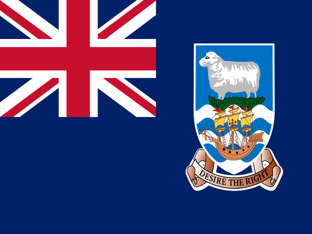
A blue field carries the UK flag in its upper-left quadrant and the Falkland Islands coat of arms centered on its right half. The coat of arms shows a white ram above the ship "Desire," whose crew discovered the islands, with a scroll at the bottom bearing the motto "DESIRE THE RIGHT."
Source: CIA World Factbook · 2026-02-01 · text generated from this source, approved by a person
Natural geography 4
Natural Earth outlines · features with a Wikidata ID
 Falkland Islands