Name
The name Bangladesh is a compound of the Bengali words "Bangla" (Bengali) and "desh" (country).
Source: CIA World Factbook · 2026-02-01 · text generated from this source, approved by a person
 Bangladesh
24.21° N, 89.68° E
4,413 km of land border against just 580 km of coast — this country faces its neighbors far more than it faces the sea.
coastline 580 km · 97th/229 · land borders 4,413 km · 43rd/230
CIA World Factbook · 2026-02-01 · ranks computed across the countries in this atlas that carry the value
geometry: Natural Earth 1:50m · EPSG:6933 equal-area
Each line is every country in this atlas that carries the value, ordered smallest to largest. The line down the middle is the world median; the mark on each line is this country.
The name Bangladesh is a compound of the Bengali words "Bangla" (Bengali) and "desh" (country).
Source: CIA World Factbook · 2026-02-01 · text generated from this source, approved by a person
At the confluence of the Ganges and Brahmaputra River systems, the huge delta was a loosely incorporated outpost of various empires during much of the first millennium CE. Muslim conversions and settlement began in the 10th century, primarily from Arab and Persian traders and preachers. After India's partition in 1947, the Muslim-majority area became East Pakistan. Calls for greater autonomy and animosity between Pakistan's eastern and western areas led to a Bengali independence movement. Led by the Awami League (AL) and supported by India, it won Bangladesh's independence war in 1971.
The military overthrew the post-independence AL government in 1975; coups followed, producing military-backed rule and the BNP, which took power in 1979. A 1981 coup ended that government, and military-backed rule continued until democratic elections in 1991. The BNP and AL alternated in power from 1991 to 2008, except during a military-backed emergency caretaker regime in 2007. The election of the AL and Prime Minister Sheikh Hasina returned the country to fully democratic rule in 2008. With international development assistance, Bangladesh is on track to graduate from the UN's Least Developed Countries (LDC) list in 2026.
Source: CIA World Factbook · 2026-02-01 · text generated from this source, approved by a person
Deltas of large rivers flowing from the Himalayas cover most of the country, which lies where the Ganges, Jamuna, and Meghna systems reach the Bay of Bengal. The Ganges unites with the Jamuna, the main channel of the Brahmaputra, then joins the Meghna before emptying into the Bay of Bengal.
Bangladesh lies in Southern Asia, bordering the Bay of Bengal between Myanmar and India. Its terrain is mostly a flat alluvial plain, with hills in the southeast. Its natural resources include natural gas, arable land, timber, and coal. Mowdok Taung is the highest point, while the Bay of Bengal is the lowest point.
Source: CIA World Factbook · 2026-02-01 · text generated from this source, approved by a person
A tropical climate brings a mild winter, a hot and humid summer, and a humid, warm, rainy monsoon. Its hazards include droughts and cyclones, and much of the country is routinely inundated during the summer monsoon season.
Source: CIA World Factbook · 2026-02-01 · text generated from this source, approved by a person
A parliamentary republic governs it. Its legal system is common law, incorporating elements of English common law; since independence, statutory law has been the primary form of legislation. Islamic law applies to Muslims in family and inheritance laws, while Hindu personal law applies to Hindus and Buddhists. The latest constitution was enacted 4 November 1972 and took effect 16 December 1972. The country gained independence from Pakistan on 16 December 1971; its national holidays are Independence Day, 26 March (1971), and Victory Day, 16 December (1971).
Source: CIA World Factbook · 2026-02-01 · text generated from this source, approved by a person
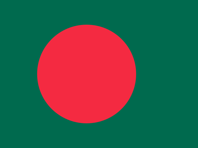
A large red disk sits slightly left on a green field. The disk represents the rising sun and the sacrifice to achieve independence, while the field symbolizes the lush vegetation of Bangladesh. The national symbols are the Bengal tiger and water lily.
Source: CIA World Factbook · 2026-02-01 · text generated from this source, approved by a person
CIA World Factbook
Values from the CIA World Factbook archive. Each carries the year it describes; open a year for the exact source field.
Natural Earth outlines · features with a Wikidata ID
Population · Natural Earth