Overview
Name
The name's meaning is disputed: one theory gives "sa" as "sacred" and "moa" as "center"; some assert it can mean "place of the sacred moa bird" of Polynesian mythology, while it may pre-date Polynesian era, with "sa'a" meaning "tribe or people" and "moa" "deep sea".
Source: CIA World Factbook · 2026-02-01 · text generated from this source, approved by a person
Background
Tutuila, settled by 1000 BCE, sheltered exiled chiefs and defeated warriors; the Manu’a Islands developed a chiefdom maintaining autonomy through oceanic trade. In 1722, Jacob Roggeveen became the first European to sail through the Manu’a Islands, followed by Louis Antoine de Bougainville in 1768. The US rejected a 1872 offer of Pago Pago rights, then established a coaling station there in 1878. In 1899, Germany and the US agreed to divide the Samoan islands, while the UK withdrew its claims for parts of the Solomon Islands. Local chiefs on Tutuila ceded their land to the US in 1900, followed by the chief of Manu’a in 1904.
The territory was officially named American Samoa in 1911, and an attempt at formal self-government was defeated in the US Congress in 1949 with help from local chiefs. Administration transferred to the Department of the Interior in 1951, and a 1967 constitution provided significant protections for traditional Samoan land-tenure rules, language, and culture. In 1977, after four attempts, voters approved a measure to directly elect their governor. American Samoa officially remains an unorganized territory, and people born there are US nationals rather than US citizens.
Source: CIA World Factbook · 2026-02-01 · text generated from this source, approved by a person
Geography
In the South Pacific Ocean, the islands lie about halfway between Hawaii and New Zealand. Volcanic islands have rugged peaks and limited coastal plains, while Rose Atoll and Swains Island are coral atolls.
Pago Pago has a natural deepwater harbor, sheltered from rough seas by its shape and from high winds by peripheral mountains. Its location in the South Pacific Ocean is strategic. Natural resources include pumice and pumicite. Lata Mountain is the highest point. The Pacific Ocean is the lowest point.
Source: CIA World Factbook · 2026-02-01 · text generated from this source, approved by a person
Government
Local self-government operates within an unincorporated, unorganized Territory of the US, whose republican form of territorial government has separate executive, legislative, and judicial branches. Its legal system mixes US common law and customary law. The Constitution was adopted 17 October 1960 and revised 1 July 1967. Independence is listed as none because it is a territory of the US. Flag Day, 17 April (1900), is the national holiday.
Source: CIA World Factbook · 2026-02-01 · text generated from this source, approved by a person
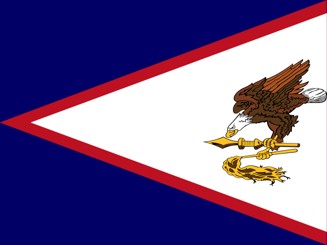 American Samoa